MyTopo
Severance Colorado US Topo Map
Couldn't load pickup availability
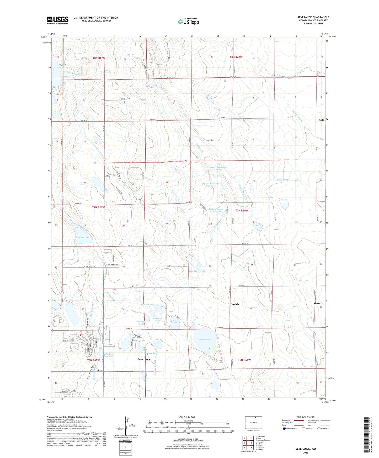
2022 topographic map quadrangle Severance in the state of Colorado. Scale: 1:24000. Based on the newly updated USGS 7.5' US Topo map series, this map is in the following counties: Weld. The map contains contour data, water features, and other items you are used to seeing on USGS maps, but also has updated roads and other features. This is the next generation of topographic maps. Printed on high-quality waterproof paper with UV fade-resistant inks.
Quads adjacent to this one:
West: Timnath
Northwest: Cobb Lake
North: Nunn
Northeast: Antelope Reservoir
East: Eaton
Southeast: Greeley
South: Bracewell
Southwest: Windsor
This map covers the same area as the classic USGS quad with code o40104e7.
Contains the following named places: Angel Lake, Angel Lake Dam, Baldridge Lake, Black Hollow Dam, Black Hollow Oil Field, Coalbank Creek, Collins Lateral, Drake Lake, Eaton-Law Dam, Eaton-Law Reservoir, Franklin Lake, Gates, Gress Reservoir, Hirsch Dairy, Hurrich, John Law Dam, John Law Ditch, King Lake, Lakeside Lateral, Law Reservoir, Loop Lake, Loup Lake Dam, New Windsor Oil Field, North Weld Sanitary Landfill, Painted Prairie Dairy, Petit Lateral, Pierce Lateral, Roulard Lake, Roulard Lateral, Schneider Lake, Severance, Severance Fire Department Station 1, Severance Fire Department Station 2, Severance Post Office, Swanson Lake, The Slough, Town of Severance, Tuber, Windsor Severence Fire Rescue Station 2, Wood Dam, Woods Lake, Wykert Number 1 Dam, Wykert Number 2 Dam, Wykert Number 4 Dam, Wykert Number 4 Reservoir, Wykert Reservoir Number 1, Wykert Reservoir Number 2, ZIP Codes: 80546, 80650