MyTopo
Nunn Colorado US Topo Map
Couldn't load pickup availability
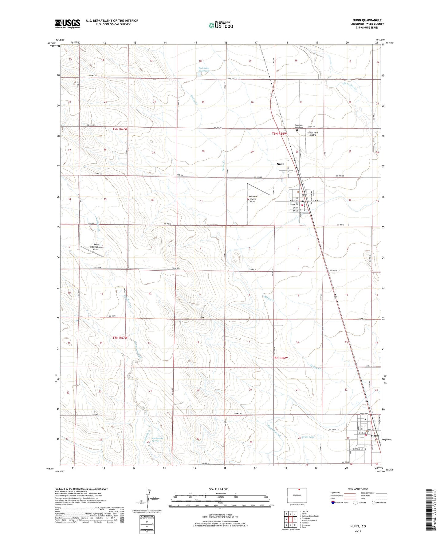
2022 topographic map quadrangle Nunn in the state of Colorado. Scale: 1:24000. Based on the newly updated USGS 7.5' US Topo map series, this map is in the following counties: Weld. The map contains contour data, water features, and other items you are used to seeing on USGS maps, but also has updated roads and other features. This is the next generation of topographic maps. Printed on high-quality waterproof paper with UV fade-resistant inks.
Quads adjacent to this one:
West: Cobb Lake
Northwest: Carr SW
North: Dover
Northeast: Eastman Creek South
East: Antelope Reservoir
Southeast: Eaton
South: Severance
Southwest: Timnath
This map covers the same area as the classic USGS quad with code o40104f7.
Contains the following named places: Ault - Pierce Fire Department Station 2, Bellmore Farms Airport, Coal Bank Watershed CB-1 Dam, Coal Bank Watershed CB-1 Reservoir, Crom Lake, Eichheim Reservoir, KSQI-FM (Greeley), KUAD-FM (Windsor), KUNC-FM (Greeley), Mountain View Cemetery, Nunn, Nunn Fire Department, Nunn Post Office, Pierce, Pierce Oil Field, Pierce Post Office, Rattlesnake Springs, Reed International Airport, Shaull Farm Airstrip, Town of Nunn, Town of Pierce