MyTopo
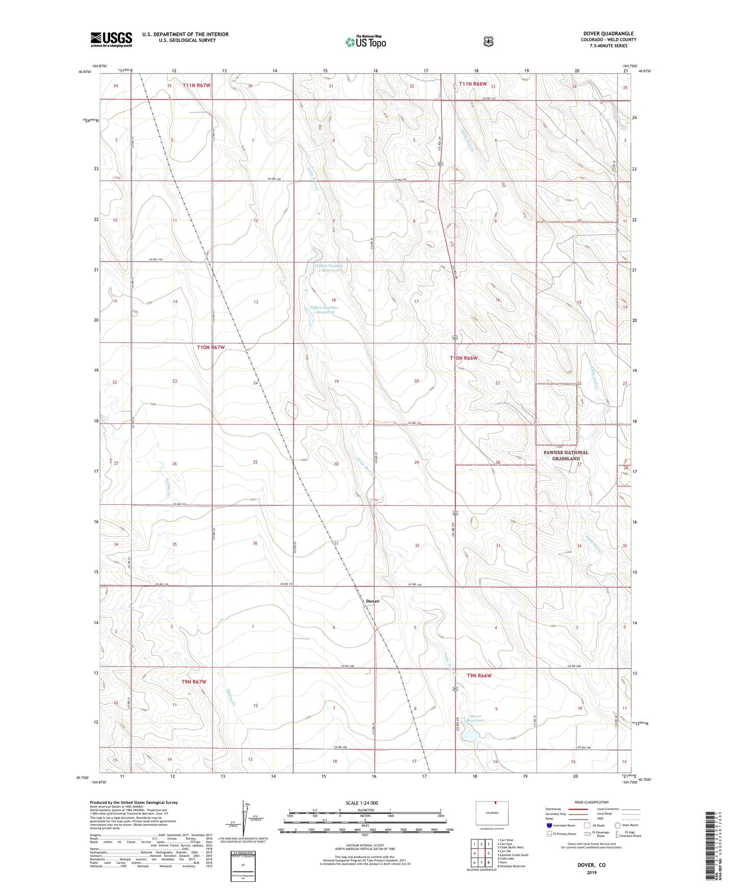
Dover Colorado US Topo Map
Couldn't load pickup availability
Also explore the Dover Forest Service Topo of this same quad for updated USFS data
2022 topographic map quadrangle Dover in the state of Colorado. Scale: 1:24000. Based on the newly updated USGS 7.5' US Topo map series, this map is in the following counties: Weld. The map contains contour data, water features, and other items you are used to seeing on USGS maps, but also has updated roads and other features. This is the next generation of topographic maps. Printed on high-quality waterproof paper with UV fade-resistant inks.
Quads adjacent to this one:
West: Carr SW
Northwest: Carr West
North: Carr East
Northeast: Chalk Bluffs West
East: Eastman Creek South
Southeast: Antelope Reservoir
South: Nunn
Southwest: Cobb Lake
This map covers the same area as the classic USGS quad with code o40104g7.
Contains the following named places: Dover, Dover Dam, Dover Reservoir, Giffon Number 1 Dam, Giffon Number 1 Reservoir, Giffon Number 2 Dam, Giffon Number 2 Reservoir, Pawnee National Grasslands Research Center, ZIP Code: 80612