MyTopo
Timnath Colorado US Topo Map
Couldn't load pickup availability
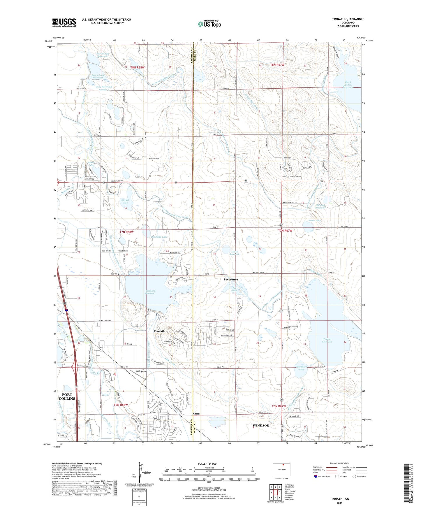
2022 topographic map quadrangle Timnath in the state of Colorado. Scale: 1:24000. Based on the newly updated USGS 7.5' US Topo map series, this map is in the following counties: Weld, Larimer. The map contains contour data, water features, and other items you are used to seeing on USGS maps, but also has updated roads and other features. This is the next generation of topographic maps. Printed on high-quality waterproof paper with UV fade-resistant inks.
Quads adjacent to this one:
West: Fort Collins
Northwest: Wellington
North: Cobb Lake
Northeast: Nunn
East: Severance
Southeast: Bracewell
South: Windsor
Southwest: Loveland
This map covers the same area as the classic USGS quad with code o40104e8.
Contains the following named places: Baker Lake, Black Hollow, Black Hollow Reservoir, Block Hollow Creek, Boxelder Ditch, Boxelder School, Cache la Poudre Reservoir Inlet, Cactus Hill Lateral, Colorado State Patrol Troop 3C Fort Collins, Deadman Lake, Dycrest Dairy, Gray Number 3 Dam, Gray Reservoir Number 3, James Lake, Kerns, Kitchel Lake, Kitchell Dam, Kluver, Lake Canal, Lake Canal Number 1 Dam, Lake Canal Reservoir Number 1, Larimer and Weld Canal, Lee Lake, Mahood Reservoir, North Gray Dam, North Gray Reservoir, Poudre Fire Authority Fire Station 8, Smith Reservoir, South Gray Dam, South Gray Reservoir, Thompson Dam, Thompson Lake, Thompson Reservoir, Timnath, Timnath Cemetery, Timnath Dam, Timnath Post Office, Timnath Reservoir, Town of Timnath, Windsor Dam, Windsor Reservoir, Windsor Reservoir Outlet, WKR Airport, Woods, ZIP Code: 80547