MyTopo
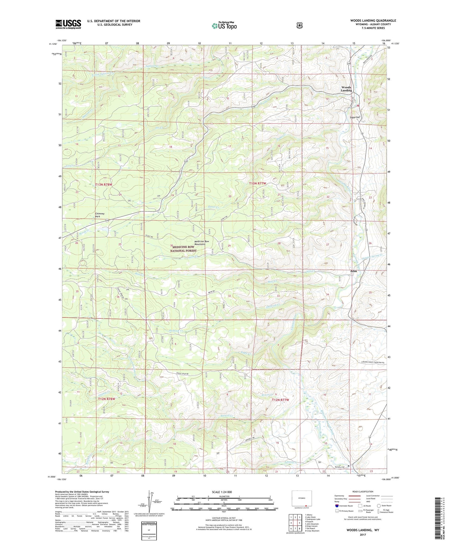
Woods Landing Wyoming US Topo Map
Couldn't load pickup availability
Also explore the Woods Landing Forest Service Topo of this same quad for updated USFS data
2021 topographic map quadrangle Woods Landing in the state of Wyoming. Scale: 1:24000. Based on the newly updated USGS 7.5' US Topo map series, this map is in the following counties: Albany. The map contains contour data, water features, and other items you are used to seeing on USGS maps, but also has updated roads and other features. This is the next generation of topographic maps. Printed on high-quality waterproof paper with UV fade-resistant inks.
Quads adjacent to this one:
West: Foxpark
Northwest: Albany
North: Lake Owen
Northeast: Sodergreen Lake
East: Jelm Mountain
Southeast: Crazy Mountain
South: Old Roach
Southwest: Kings Canyon
This map covers the same area as the classic USGS quad with code o41106a1.
Contains the following named places: Annie Mine, Bear Creek, Beaver Creek, Bosewll Creek Campground, Boswell Creek, Boswell Ranch, Chimney Park, Chimney Park Camp, Eagle Creek, Fox Creek, Gramm Creek, Jelm, Jelm Creek, Jelm Mountain Area Mine, Jelm P O, New Jelm, North Fork Gramm Creek, North Fork Squirrel Creek, Pollock Draw, Porter Creek, Shellrock Creek, Squirrel Creek, Sugarloaf, Sunrise Spring Creek, Woods Creek, Woods Landing, Woods Landing-Jelm Census Designated Place