MyTopo
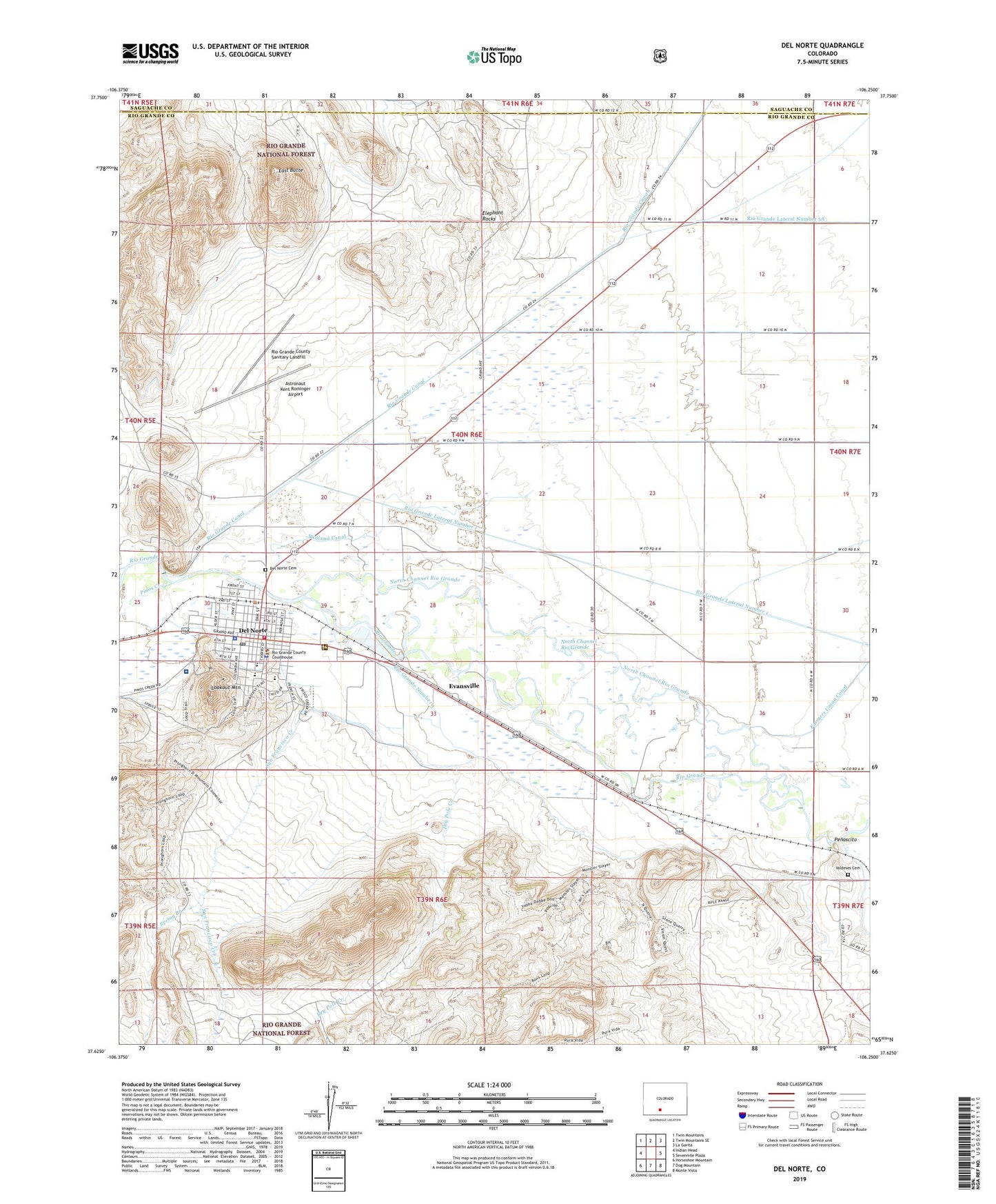
Del Norte Colorado US Topo Map
Couldn't load pickup availability
Also explore the Del Norte Forest Service Topo of this same quad for updated USFS data
2022 topographic map quadrangle Del Norte in the state of Colorado. Scale: 1:24000. Based on the newly updated USGS 7.5' US Topo map series, this map is in the following counties: Rio Grande, Saguache. The map contains contour data, water features, and other items you are used to seeing on USGS maps, but also has updated roads and other features. This is the next generation of topographic maps. Printed on high-quality waterproof paper with UV fade-resistant inks.
Quads adjacent to this one:
West: Indian Head
Northwest: Twin Mountains
North: Twin Mountains SE
Northeast: La Garita
East: Sevenmile Plaza
Southeast: Monte Vista
South: Dog Mountain
Southwest: Horseshoe Mountain
This map covers the same area as the classic USGS quad with code o37106f3.
Contains the following named places: Astronaut Kent Rominger Airport, Catholic Church, Church of Jesus Christ of Latter - day Saints, Del Norte, Del Norte Baptist Fellowship, Del Norte Cemetery, Del Norte Community Ambulance, Del Norte Emergency Medical Services, Del Norte Fire Department, Del Norte Police Department, Del Norte Post Office, Del Norte Town Ditch, Dry Pole Creek, East Butte, Elephant Rocks, Evansville, Gateway Baptist Church, KGCA-AM (Del Norte), Lookout Mountain, McIntosh Arroyo Ditch, Midland Canal, New Life Fellowship, North Channel Rio Grande, Penascito, Pinos Creek, Pioneer United Church, Raber Ditch, Rio Grande County Jail, Rio Grande County Sanitary Landfill, Rio Grande Ditch 2, Rio Grande Hospital, Rio Grande Number 1, Rio Grande Sheriff's Office, Rio Granite Granite Quarry, San Francisco Creek, Silva Ditch, Spiegel Mine, Spring Branch, Town of Del Norte, Valdeses Cemetery