MyTopo
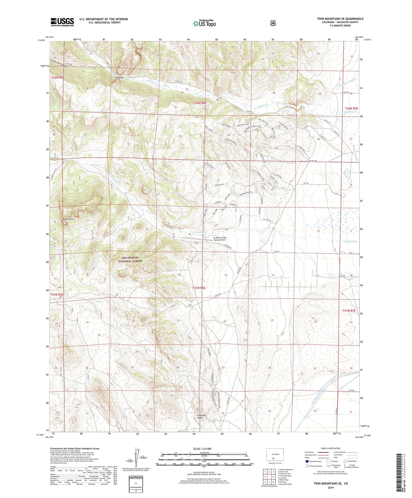
Twin Mountains SE Colorado US Topo Map
Couldn't load pickup availability
Also explore the Twin Mountains SE Forest Service Topo of this same quad for updated USFS data
2022 topographic map quadrangle Twin Mountains SE in the state of Colorado. Scale: 1:24000. Based on the newly updated USGS 7.5' US Topo map series, this map is in the following counties: Saguache. The map contains contour data, water features, and other items you are used to seeing on USGS maps, but also has updated roads and other features. This is the next generation of topographic maps. Printed on high-quality waterproof paper with UV fade-resistant inks.
Quads adjacent to this one:
West: Twin Mountains
Northwest: Lookout Mountain
North: Lime Creek
Northeast: Swede Corners
East: La Garita
Southeast: Sevenmile Plaza
South: Del Norte
Southwest: Indian Head
This map covers the same area as the classic USGS quad with code o37106g3.
Contains the following named places: Barrel Spring, Biedell Ditch Number 10, Canada Ancha, Castor Creek, Center Division, Coolbroth Canyon, Crystal Hill Mine, Eagle Rock, Ghost Mine, Hellgate, Holland Ditch, Home Ditch Number 1, Juan Trujillo Ditch, La Garita Creek Ranch Airport, Little La Garita Creek, Saint John Church, Shaw Springs