MyTopo
Devils Hole Gulch Colorado US Topo Map
Couldn't load pickup availability
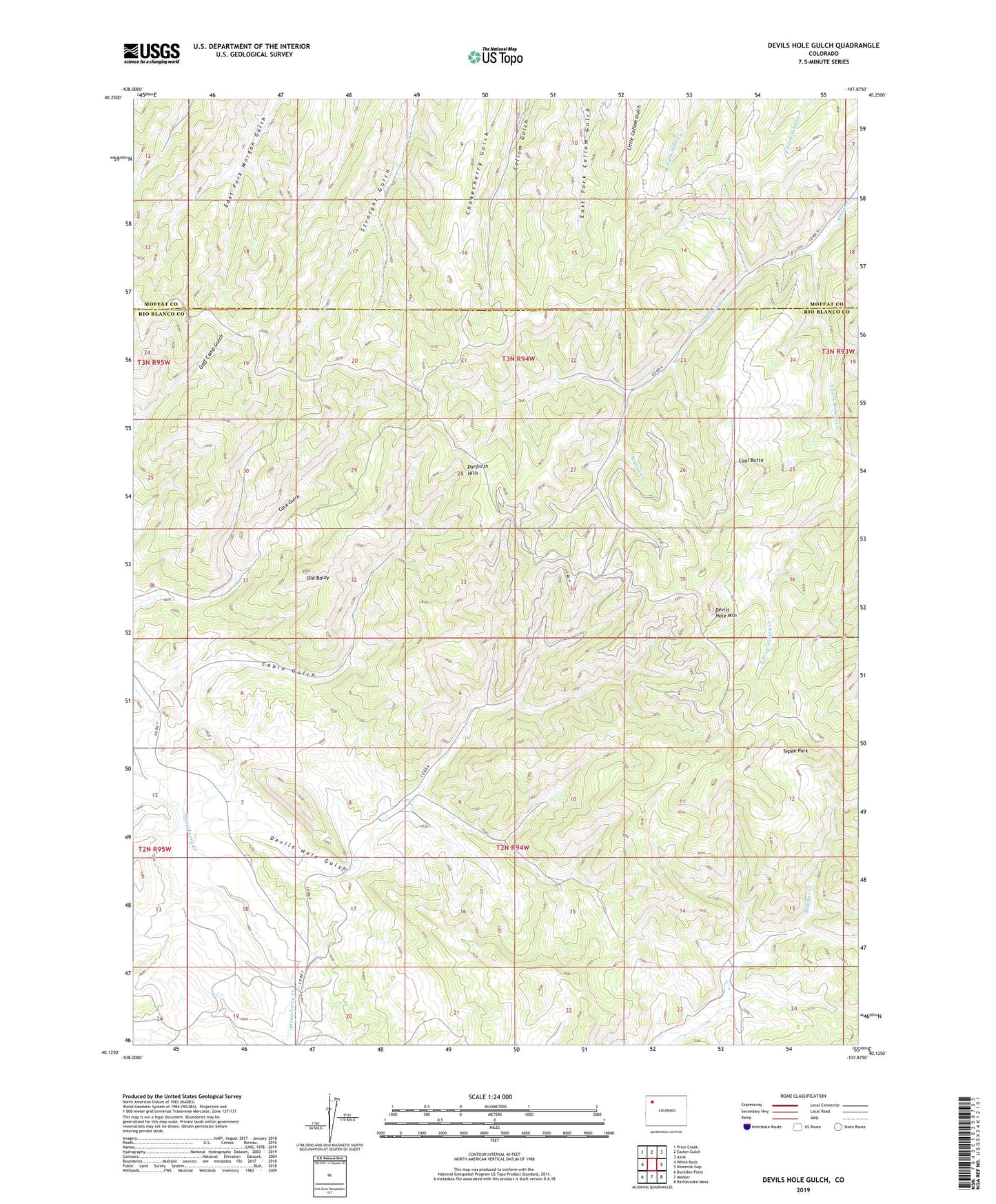
2022 topographic map quadrangle Devils Hole Gulch in the state of Colorado. Scale: 1:24000. Based on the newly updated USGS 7.5' US Topo map series, this map is in the following counties: Rio Blanco, Moffat. The map contains contour data, water features, and other items you are used to seeing on USGS maps, but also has updated roads and other features. This is the next generation of topographic maps. Printed on high-quality waterproof paper with UV fade-resistant inks.
Quads adjacent to this one:
West: White Rock
Northwest: Price Creek
North: Easton Gulch
Northeast: Axial
East: Ninemile Gap
Southeast: Rattlesnake Mesa
South: Meeker
Southwest: Buckskin Point
This map covers the same area as the classic USGS quad with code o40107b8.
Contains the following named places: Cabin Gulch, Coal Butte, Devils Hole Gulch, Devils Hole Mountain, East Fork Wilson Creek, KQZR-FM (Craig), Old Baldy, Tepee Park, Wilson Creek Camp, Wilson Creek Oil Field