MyTopo
Meeker Colorado US Topo Map
Couldn't load pickup availability
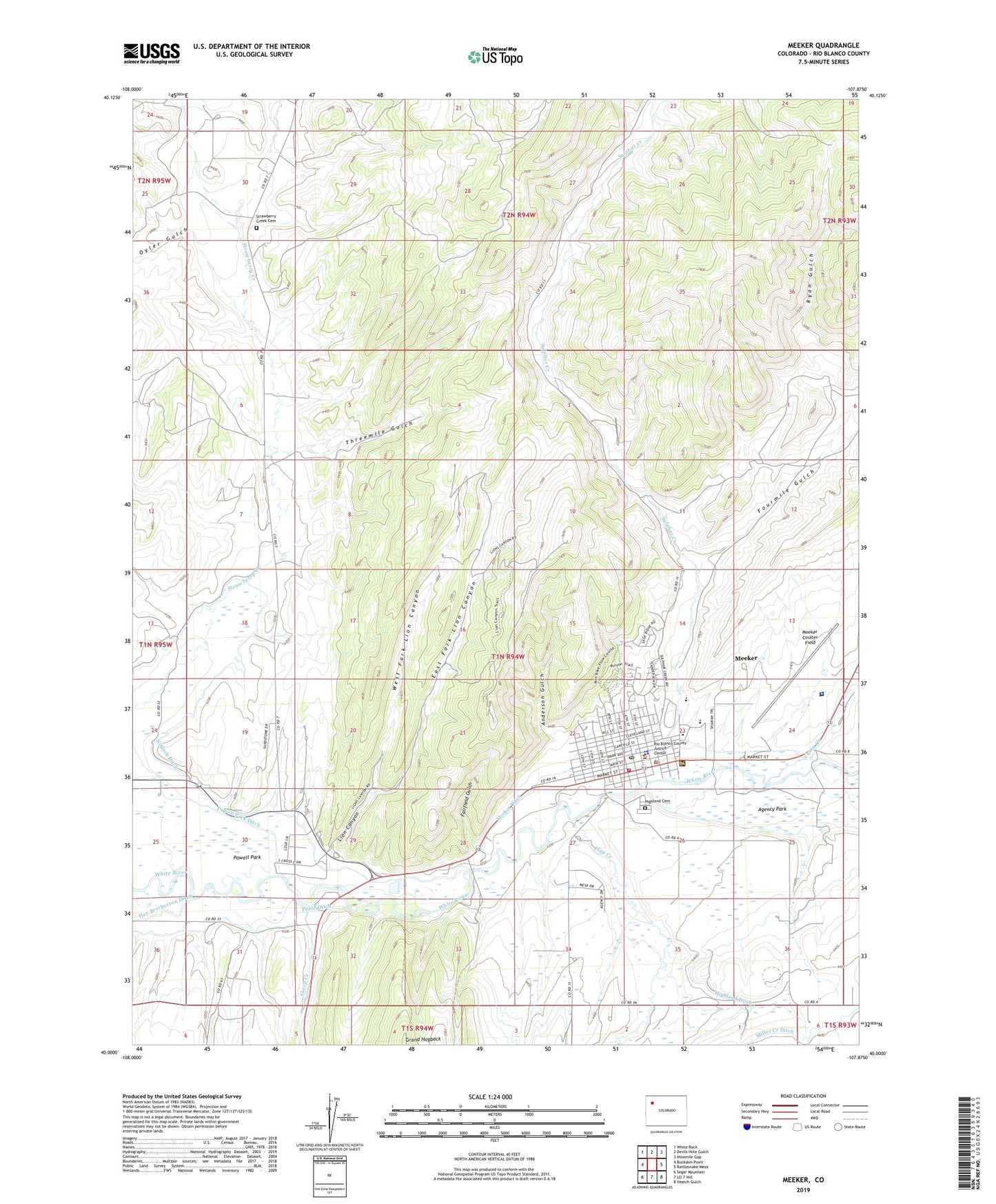
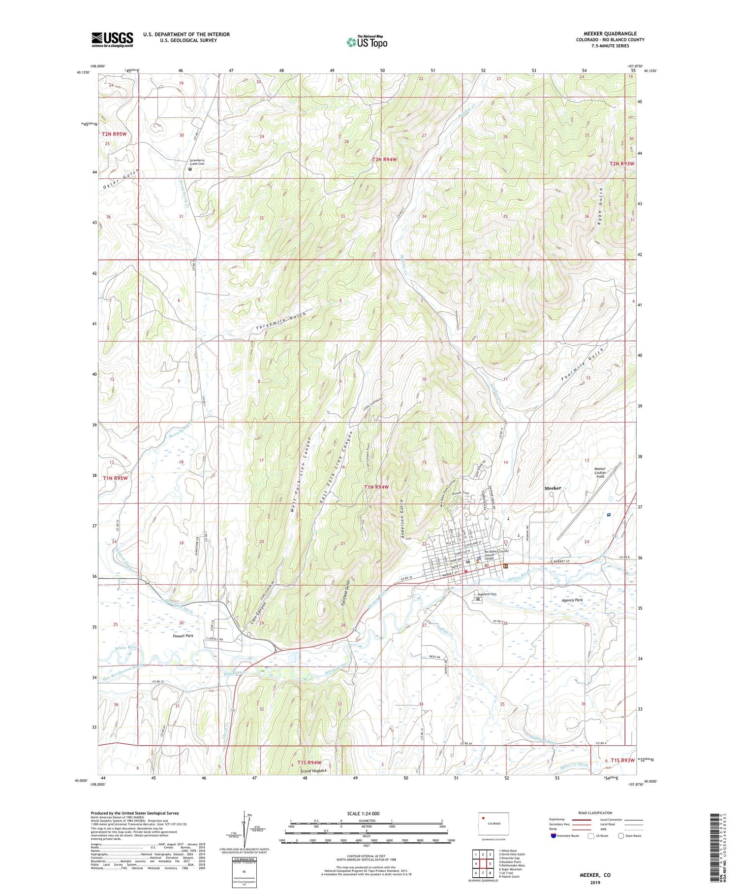
2022 topographic map quadrangle Meeker in the state of Colorado. Scale: 1:24000. Based on the newly updated USGS 7.5' US Topo map series, this map is in the following counties: Rio Blanco. The map contains contour data, water features, and other items you are used to seeing on USGS maps, but also has updated roads and other features. This is the next generation of topographic maps. Printed on high-quality waterproof paper with UV fade-resistant inks.
Quads adjacent to this one:
West: Buckskin Point
Northwest: White Rock
North: Devils Hole Gulch
Northeast: Ninemile Gap
East: Rattlesnake Mesa
Southeast: Veatch Gulch
South: LO 7 Hill
Southwest: Segar Mountain
This map covers the same area as the classic USGS quad with code o40107a8.
Contains the following named places: Anderson Gulch, Black Diamond Mine, Bloomfield Pit, Clyde Dam, Clyde Reservoir, Colowyo Mine, Curtis Creek, East Fork Lion Canyon, Fairfield Gulch, Fairfield Mine, Flag Creek, Fourmile Gulch, Highland Cemetery, KMKR-AM (Meeker), Lion Canyon, Lion Canyon Mine, Meeker, Meeker Coulter Field, Meeker Ditch, Meeker Massacre, Meeker Police Department, Meeker Post Office, Meeker Volunteer Fire and Rescue, Niblock Ditch, North Meeker Coal Mine, Northern Number One Mine, Oyler Gulch, Pease Ditch, Pioneers Heliport, Pioneers Medical Center, Rio Blanco County Detention Center, Rio Blanco County Sheriff's Office, Ryan Gulch, Sheep Creek, Strawberry Creek Cemetery, Sulphur Creek, Threemile Gulch, Town of Meeker, West Fork Lion Canyon