MyTopo
Buckskin Point Colorado US Topo Map
Couldn't load pickup availability
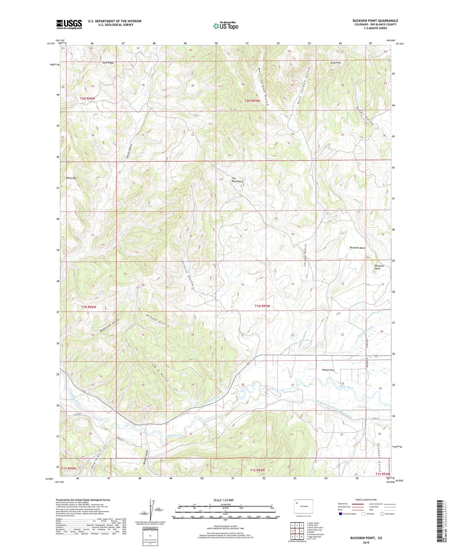
2022 topographic map quadrangle Buckskin Point in the state of Colorado. Scale: 1:24000. Based on the newly updated USGS 7.5' US Topo map series, this map is in the following counties: Rio Blanco. The map contains contour data, water features, and other items you are used to seeing on USGS maps, but also has updated roads and other features. This is the next generation of topographic maps. Printed on high-quality waterproof paper with UV fade-resistant inks.
Quads adjacent to this one:
West: White River City
Northwest: Indian Valley
North: White Rock
Northeast: Devils Hole Gulch
East: Meeker
Southeast: LO 7 Hill
South: Segar Mountain
Southwest: Greasewood Gulch
This map covers the same area as the classic USGS quad with code o40108a1.
Contains the following named places: Black Mountain, Buckskin Mesa, Buckskin Point, East Jordan Gulch, Grassy Gulch, Hay Bretherton Ditch, Hay Gulch, Jordan Gulch, Kendall Gulch, LO 7 Gulch, Powell Park, Powell Park Ditch, Puckett Gulch, Strawberry Creek, The Monument, West Jordan Gulch, Windy Gulch