MyTopo
Electric Mountain Colorado US Topo Map
Couldn't load pickup availability
Also explore the Electric Mountain Forest Service Topo of this same quad for updated USFS data
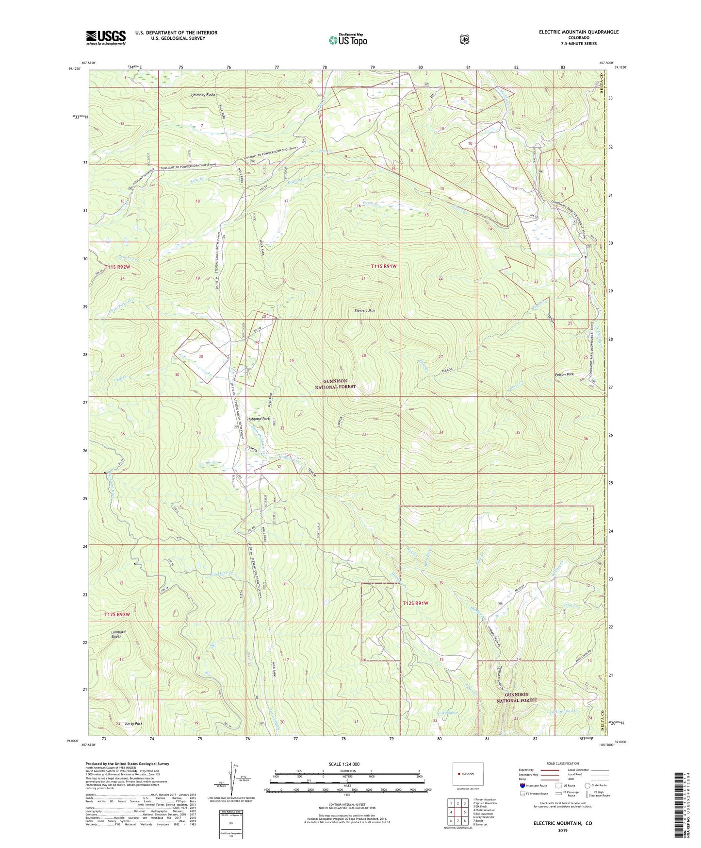
2022 topographic map quadrangle Electric Mountain in the state of Colorado. Scale: 1:24000. Based on the newly updated USGS 7.5' US Topo map series, this map is in the following counties: Delta, Gunnison. The map contains contour data, water features, and other items you are used to seeing on USGS maps, but also has updated roads and other features. This is the next generation of topographic maps. Printed on high-quality waterproof paper with UV fade-resistant inks.
Quads adjacent to this one:
West: Chalk Mountain
Northwest: Porter Mountain
North: Spruce Mountain
Northeast: Elk Knob
East: Bull Mountain
Southeast: Somerset
South: Bowie
Southwest: Gray Reservoir
This map covers the same area as the classic USGS quad with code o39107a5.
Contains the following named places: Beaver Creek, Big Alder Creek, Branch of Bee Creek, Bulk Park Ditch, Chimney Rocks, Columbine Ditch Nuber One, Columbine Ditch Nuber Two, Columbine Ditch Number Five, Columbine Ditch Number Three, Columbine Ranch, Cottonwood Creek, Cow Creek, Dyke Ditch Number Two, Electric Mountain, Elk Creek, Fawn Creek, Flying M Ranch, Grouse Spring, Hubbard Park, Little Alder Creek, Little Dyke Creek, Lombard Slides, Lone Pine Creek, Main Hubbard Creek, Middle Hubbard Creek, Molly Group Mine, Morman Creek, Norells Bell Ranch, Pilot Creek, Poison Park, Slide Creek, Terror Trail, Trail Creek, Twin Spruce Ditch, West Hubbard Creek, West Muddy Ranger Station, Willow Creek, Wolf Creek