MyTopo
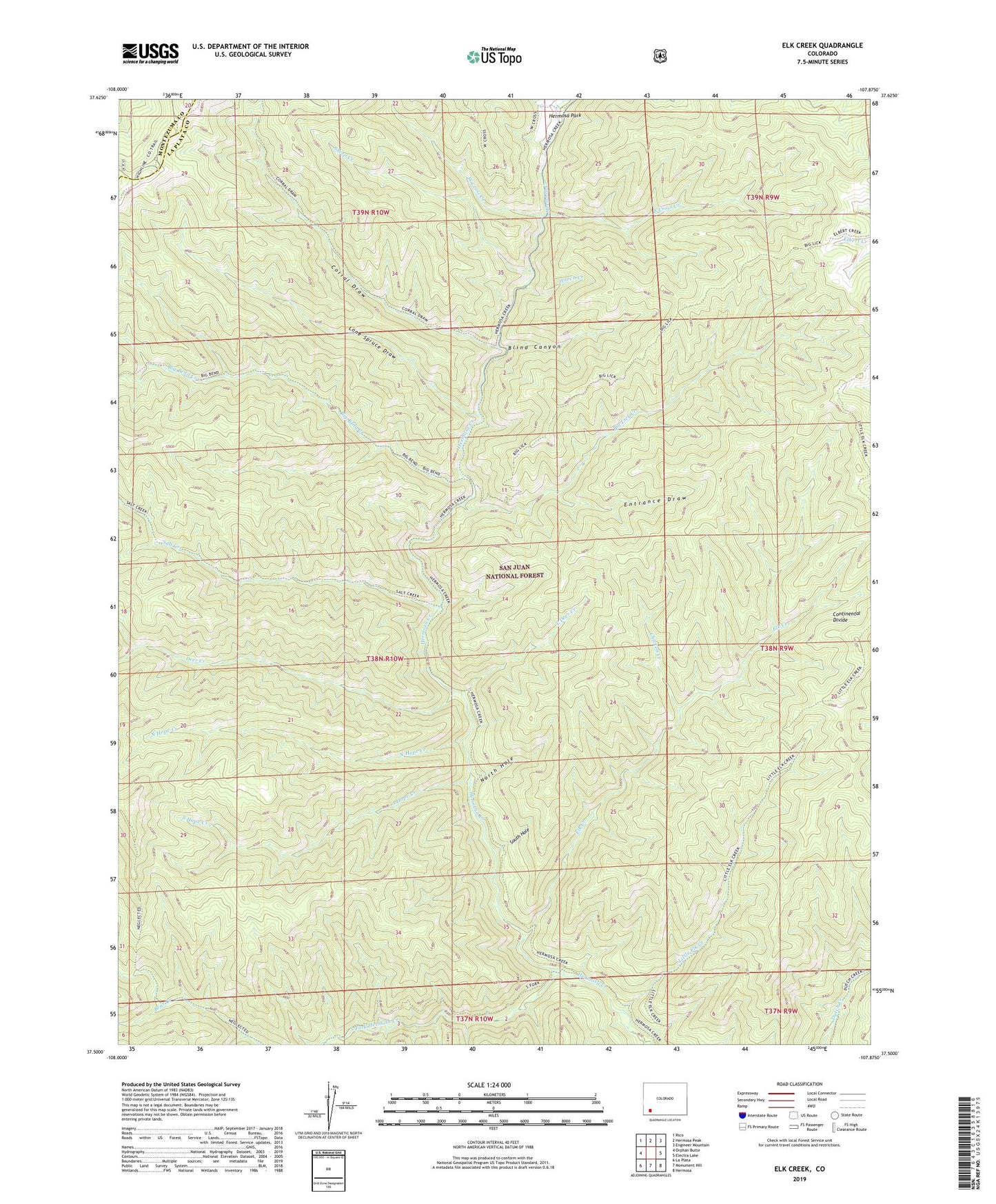
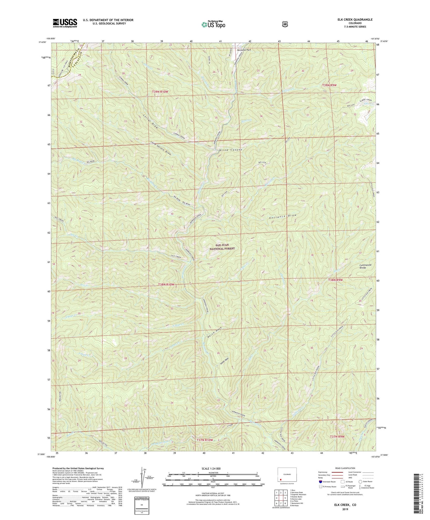
Elk Creek Colorado US Topo Map
Couldn't load pickup availability
Also explore the Elk Creek Forest Service Topo of this same quad for updated USFS data
2022 topographic map quadrangle Elk Creek in the state of Colorado. Scale: 1:24000. Based on the newly updated USGS 7.5' US Topo map series, this map is in the following counties: La Plata, Montezuma. The map contains contour data, water features, and other items you are used to seeing on USGS maps, but also has updated roads and other features. This is the next generation of topographic maps. Printed on high-quality waterproof paper with UV fade-resistant inks.
Quads adjacent to this one:
West: Orphan Butte
Northwest: Rico
North: Hermosa Peak
Northeast: Engineer Mountain
East: Electra Lake
Southeast: Hermosa
South: Monument Hill
Southwest: La Plata
This map covers the same area as the classic USGS quad with code o37107e8.
Contains the following named places: Big Bend Creek, Big Lick Creek, Blind Canyon, Chicken Creek, Corral Draw, Deer Creek, East Cross Creek, East Deer Creek, East Fork Hermosa Creek, Elk Creek, Entrance Draw, Goodhope Stock Driveway, Hermosa Creek Wilderness, Hooch Creek, Little Elk Creek, Lone Spruce Draw, North Hole, North Hope Creek, Salt Creek, Sheep Creek, South Fork Hermosa Creek, South Hole, South Hope Creek, West Cross Creek