
MyTopo
Monument Hill Colorado US Topo Map
Couldn't load pickup availability
Also explore the Monument Hill Forest Service Topo of this same quad for updated USFS data
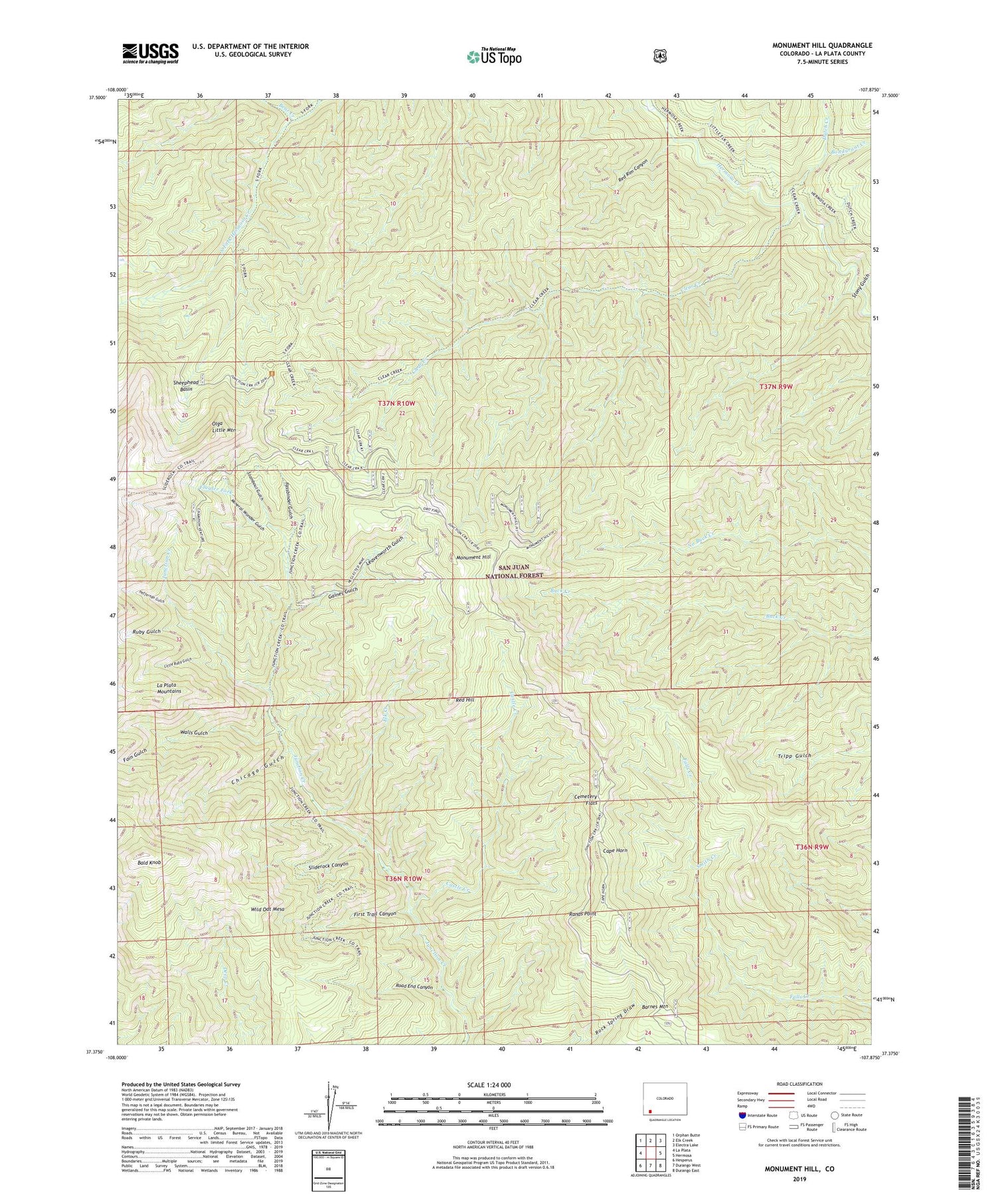
2022 topographic map quadrangle Monument Hill in the state of Colorado. Scale: 1:24000. Based on the newly updated USGS 7.5' US Topo map series, this map is in the following counties: La Plata. The map contains contour data, water features, and other items you are used to seeing on USGS maps, but also has updated roads and other features. This is the next generation of topographic maps. Printed on high-quality waterproof paper with UV fade-resistant inks.
Quads adjacent to this one:
West: La Plata
Northwest: Orphan Butte
North: Elk Creek
Northeast: Electra Lake
East: Hermosa
Southeast: Durango East
South: Durango West
Southwest: Hesperus
This map covers the same area as the classic USGS quad with code o37107d8.
Contains the following named places: At Last Ranch, Bald Knob, Barnes Mountain, Bear Creek, Bondurant Creek, Cape Horn, Castle Creek, Cemetery Flats, Checkmaker Mine, Chicago Gulch, Clear Creek, Durango Division, Durango Girl Mine, Dutch Creek, Elk Creek, Fassbinder Gulch, First Trail Canyon, Flagler Fork, Foin Gulch, Gaines Gulch, George A Greenwood Group Mine, Gold King Mine, Gold Nugget Group Mine, Heffernan Gulch, Junction Creek Claims, Kennebec Mine, Last Chance Mine, Leavenworth Gulch, Little Ruby Gulch, Mary S Mine, Mineral Wonder Gulch, Mineral Wonder Mine, Monument Hill, Monument Hill Mine, Neglected Mine, Olga Little Mountain, Oro Fino Mine, Rands Point, Red Hill, Red Rim Canyon, Road End Canyon, Ruby Gulch, Ruby King Mine, Sheephead Basin, Sliderock Canyon, Sliderock Mountain, Smith Creek, Stamboul Gulch, Stony Gulch, Walls Gulch, Wheel of Fortune Mine, Wild Oat Mesa


