MyTopo
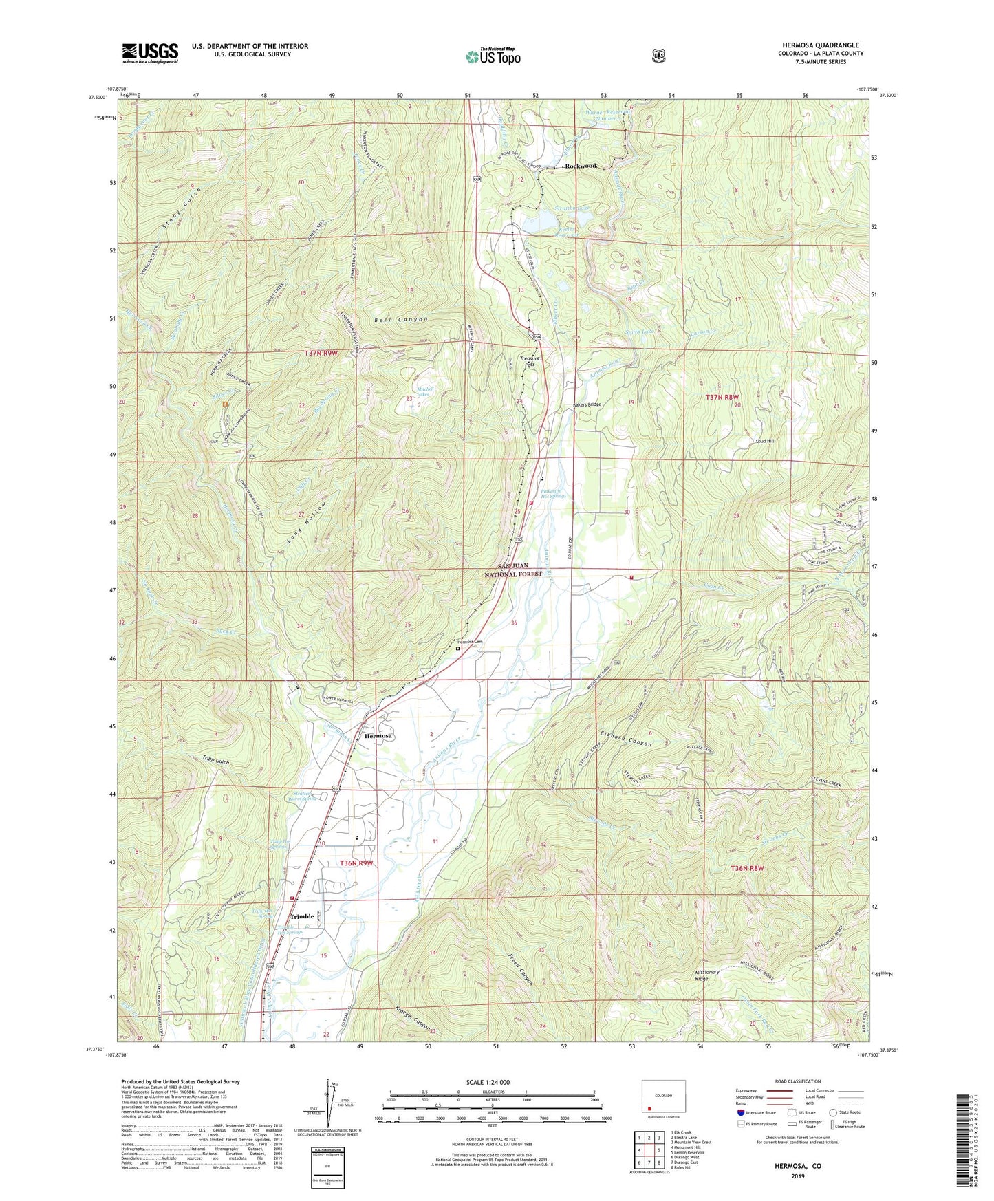
Hermosa Colorado US Topo Map
Couldn't load pickup availability
Also explore the Hermosa Forest Service Topo of this same quad for updated USFS data
2022 topographic map quadrangle Hermosa in the state of Colorado. Scale: 1:24000. Based on the newly updated USGS 7.5' US Topo map series, this map is in the following counties: La Plata. The map contains contour data, water features, and other items you are used to seeing on USGS maps, but also has updated roads and other features. This is the next generation of topographic maps. Printed on high-quality waterproof paper with UV fade-resistant inks.
Quads adjacent to this one:
West: Monument Hill
Northwest: Elk Creek
North: Electra Lake
Northeast: Mountain View Crest
East: Lemon Reservoir
Southeast: Rules Hill
South: Durango East
Southwest: Durango West
This map covers the same area as the classic USGS quad with code o37107d7.
Contains the following named places: Animas Valley Consolidated Ditch, Animas Valley Elementary School, Bakers Bridge, Bear Creek, Bell Canyon, Big Spring Creek, Buck Creek, Carson Creek, Cliff Creek, Colorado Timberline Academy, Coon Creek, Durango Fire and Rescue Authority Station 10 - Elkhorn Ranch, Durango Fire and Rescue Authority Station 12 - Timberline Station, Durango Fire and Rescue Authority Station 6 - Trimble Station, Elbert Creek, Elkhorn Canyon, Freed Canyon, Goulding Creek, Hermosa, Hermosa Cemetery, Hermosa Creek, Jones Creek, Keeler Dam, Kroeger Canyon, Long Hollow, Middle Fork Coon Creek, Mitchell Lakes, No Buck Creek, North Fork Coon Creek, Painter Placer, Pinkerton Hot Springs, Poverty Hill Mine, Reid Ditch, Rockwood, Shalona Lake, Silver Creek, Smith Lake, South Fork Coon Creek, Spruce Haven Camp, Spud Hill, Stevens Creek, Stratten Warm Spring, Stratton Lake, Swampy Creek, Treasure Pass, Trimble, Trimble Forest Service Facility, Trimble Hot Springs, Tripp Gulch, Tripp Gulch Mine, Tripp Hot Spring, Tripp Hot Springs, Warner Number 5 Dam, Warner Reservoir Number 5, ZIP Code: 81301