MyTopo
Emerald Lake Colorado US Topo Map
Couldn't load pickup availability
Also explore the Emerald Lake Forest Service Topo of this same quad for updated USFS data
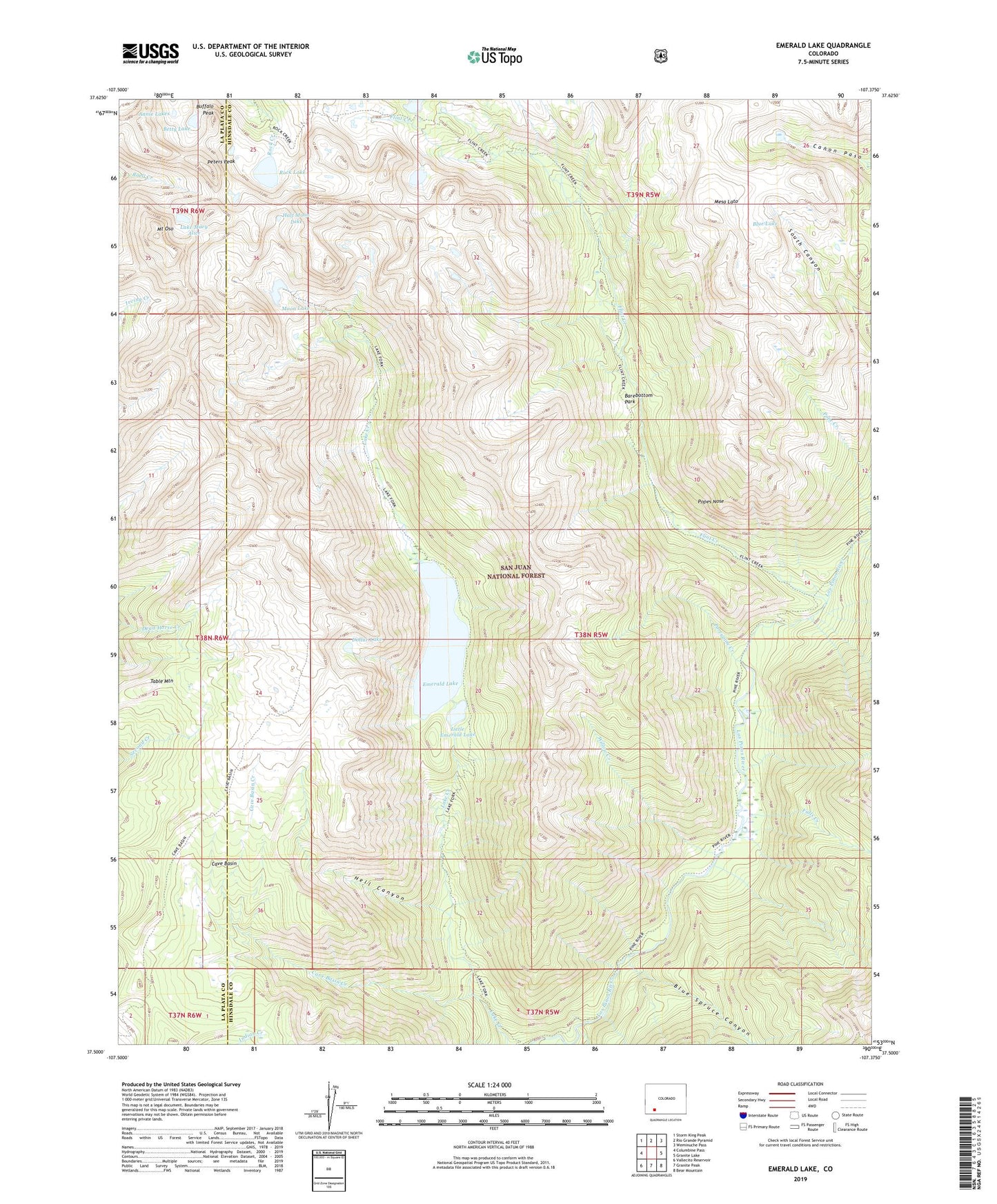
2022 topographic map quadrangle Emerald Lake in the state of Colorado. Scale: 1:24000. Based on the newly updated USGS 7.5' US Topo map series, this map is in the following counties: Hinsdale, La Plata. The map contains contour data, water features, and other items you are used to seeing on USGS maps, but also has updated roads and other features. This is the next generation of topographic maps. Printed on high-quality waterproof paper with UV fade-resistant inks.
Quads adjacent to this one:
West: Columbine Pass
Northwest: Storm King Peak
North: Rio Grande Pyramid
Northeast: Weminuche Pass
East: Granite Lake
Southeast: Bear Mountain
South: Granite Peak
Southwest: Vallecito Reservoir
This map covers the same area as the classic USGS quad with code o37107e4.
Contains the following named places: Barebottom Park, Betty Lake, Blue Lake, Blue Spruce Canyon, Buffalo Peak, Cave Basin, Cave Basin Creek, Dollar Lake, Emerald Lake, Falls Creek, Flint Creek, Half Moon Lake, Hell Canyon, Lake Mary Alice, Little Emerald Lake, Mesa Lato, Moon Lake, Mount Oso, Peters Peak, Popes Nose, Porcupine Creek, Rock Lake, Table Mountain, Willow Creek