MyTopo
Storm King Peak Colorado US Topo Map
Couldn't load pickup availability
Also explore the Storm King Peak Forest Service Topo of this same quad for updated USFS data
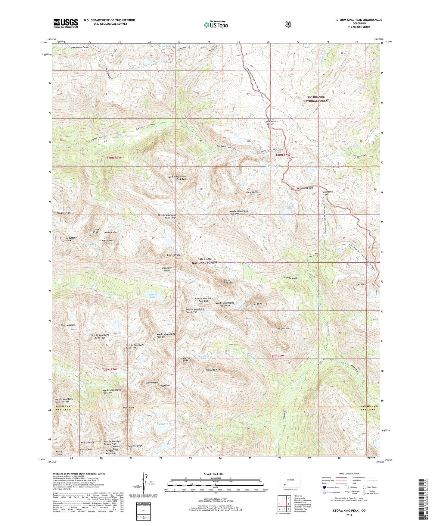
2022 topographic map quadrangle Storm King Peak in the state of Colorado. Scale: 1:24000. Based on the newly updated USGS 7.5' US Topo map series, this map is in the following counties: San Juan, La Plata. The map contains contour data, water features, and other items you are used to seeing on USGS maps, but also has updated roads and other features. This is the next generation of topographic maps. Printed on high-quality waterproof paper with UV fade-resistant inks.
Quads adjacent to this one:
West: Snowdon Peak
Northwest: Silverton
North: Howardsville
Northeast: Pole Creek Mountain
East: Rio Grande Pyramid
Southeast: Emerald Lake
South: Columbine Pass
Southwest: Mountain View Crest
This map covers the same area as the classic USGS quad with code o37107f5.
Contains the following named places: Arrow Lake, Arrow Peak, Balsam Lake, Beartown, Eldorado Lake, Electric Peak, Glacier Point, Gold Bug Mine, Golden Shear Group Mine, Good Hope Mine, Gray Needle, Graystone Peak, Grenadier Range, Hunchback Mountain, Hunchback Pass, Jagged Mountain, Kite Lake, Knife Point, Lake Silex, Leviathan Creek, Leviathan Lake, Leviathan Peak, Little May Mine, Lost Lake, Mount Nebo, Mount Silex, Nebo Creek, Needle Ridge, North Eolus, Peak Eight, Peak Eleven, Peak Five, Peak Four, Peak Nine, Peak One, Peak Seven, Peak Six, Peak Ten, Peak Thirteen, Peak Three, Peak Two, Rock Creek, Storm King Peak, Stormy Gulch, Sunlight Creek, Sunlight Lake, Sunlight Peak, The Guardian, The Heisspitz, Trinity Creek, Trinity Lake, Trinity Peaks, Twin Thumbs, Vallecito Lake, Vallecito Mountain, Verde Lake, Vestal Lake, Vestal Peak, Wham Ridge, White Dome