
MyTopo
Columbine Pass Colorado US Topo Map
Couldn't load pickup availability
Also explore the Columbine Pass Forest Service Topo of this same quad for updated USFS data
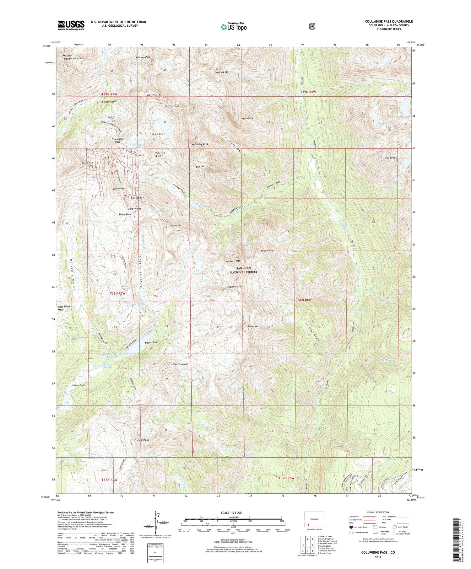
2022 topographic map quadrangle Columbine Pass in the state of Colorado. Scale: 1:24000. Based on the newly updated USGS 7.5' US Topo map series, this map is in the following counties: La Plata. The map contains contour data, water features, and other items you are used to seeing on USGS maps, but also has updated roads and other features. This is the next generation of topographic maps. Printed on high-quality waterproof paper with UV fade-resistant inks.
Quads adjacent to this one:
West: Mountain View Crest
Northwest: Snowdon Peak
North: Storm King Peak
Northeast: Rio Grande Pyramid
East: Emerald Lake
Southeast: Granite Peak
South: Vallecito Reservoir
Southwest: Lemon Reservoir
This map covers the same area as the classic USGS quad with code o37107e5.
Contains the following named places: Aetna Mine, Amherst Mountain, Aztec Mountain, Bullion Mountain, Castilleja Lake, Chicago Basin, City Reservoir, Columbine Lake, Columbine Pass, Crystal Valley, Dead Horse Creek, Durango Number 1 Dam, Durango Reservoir Number 1, Echo Mountain, Emerson Mountain, Endlich Mesa, First Creek, Florida Mountain, Gold Nugget Claim, Greylock Mountain, Grizzly Gulch, Grizzly Peak, Hazel Lake, Hidden Lake, Hope Mountain, Irving Creek, Irving Lake, Irving Peak, Johnson Creek, Jupiter Mountain, Lake Marie, Lillie Lake, Logtown, Lost Lake, Lower Park, McCauley Peak, Missouri Gulch, Mount Eolus, Mount Valois, Needle Mountains, Organ Mountain, Pittsburg Mine, Roell Creek, Second Creek, Sheep Draw, Sheep Mountain, Sheridan Mountain, Silver Mesa, Soda Spring, Taylor Creek, Thunder Mountain, Trimble Pass, Upper Park, Vallecito Basin, Vallecito Group Mine, Windom Peak


