
MyTopo
Fly Creek Colorado US Topo Map
Couldn't load pickup availability
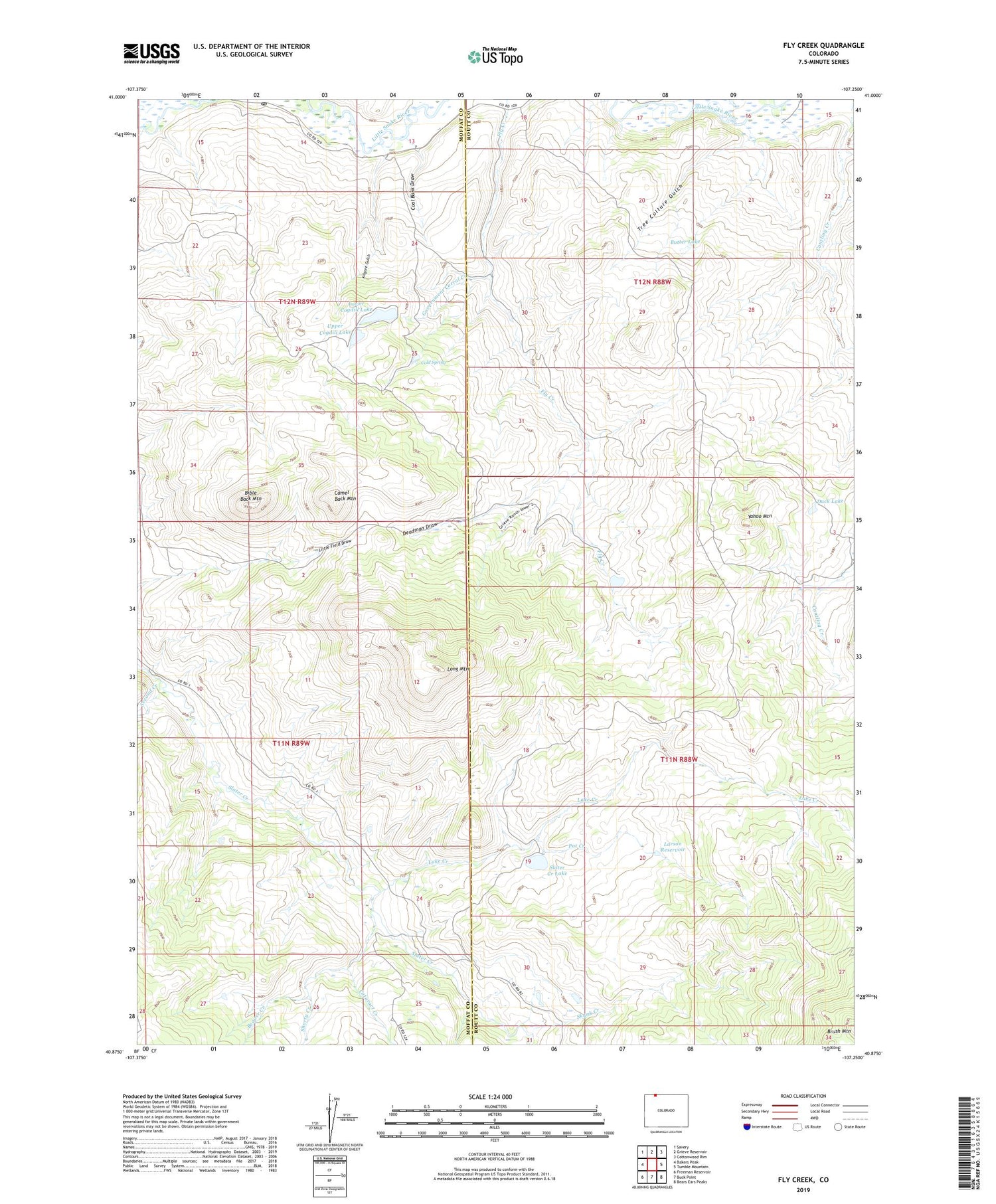
2022 topographic map quadrangle Fly Creek in the state of Colorado. Scale: 1:24000. Based on the newly updated USGS 7.5' US Topo map series, this map is in the following counties: Moffat, Routt. The map contains contour data, water features, and other items you are used to seeing on USGS maps, but also has updated roads and other features. This is the next generation of topographic maps. Printed on high-quality waterproof paper with UV fade-resistant inks.
Quads adjacent to this one:
West: Bakers Peak
Northwest: Savery
North: Grieve Reservoir
Northeast: Cottonwood Rim
East: Tumble Mountain
Southeast: Bears Ears Peaks
South: Buck Point
Southwest: Freeman Reservoir
This map covers the same area as the classic USGS quad with code o40107h3.
Contains the following named places: Beaver Creek, Bible Back Mountain, Butter Lake, Camel Back Mountain, Cataract Creek, Coal Bank Draw, Codhill-Upper Dam, Coghill-Lower Dam, Coghill-Lower Reservoir, Cold Spring, Deadman Draw, Duck Lake, Government Corral Creek, Kilgore Gulch, Lake Creek, Larson Reservoir, Long Mountain, Lower Cogdill Lake, Pat Creek, Roaring Fork, Second Creek, Shorty Creek, Skunk Creek, Slater Creek Lake, Slater Post Office, Tree Culture Gulch, Upper Cogdill Lake, Yahoo Mountain


