MyTopo
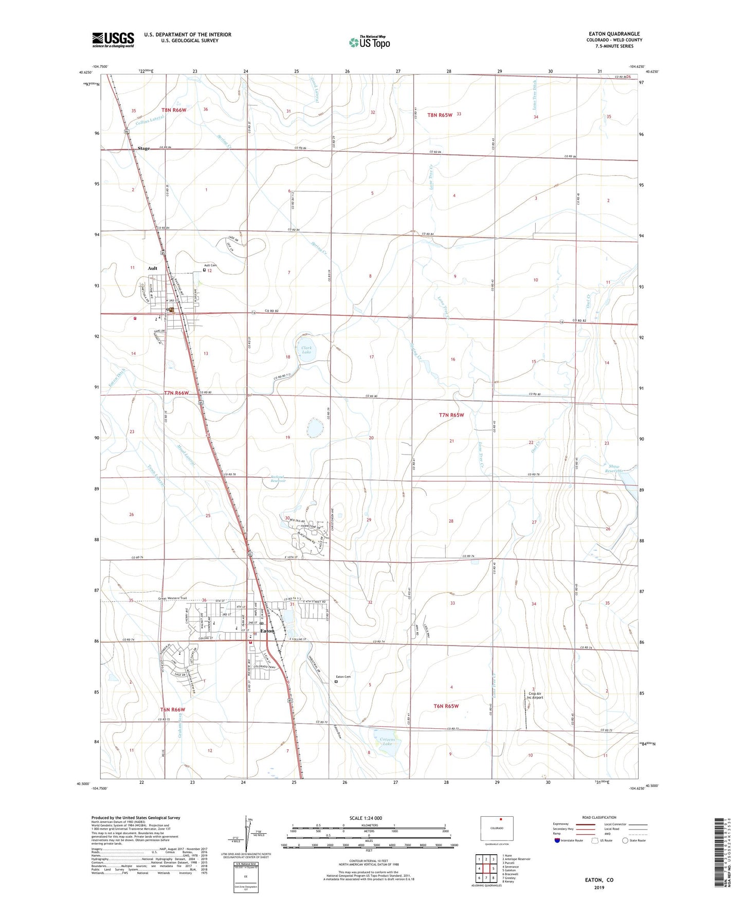
Eaton Colorado US Topo Map
Couldn't load pickup availability
Also explore the Eaton Forest Service Topo of this same quad for updated USFS data
2022 topographic map quadrangle Eaton in the state of Colorado. Scale: 1:24000. Based on the newly updated USGS 7.5' US Topo map series, this map is in the following counties: Weld. The map contains contour data, water features, and other items you are used to seeing on USGS maps, but also has updated roads and other features. This is the next generation of topographic maps. Printed on high-quality waterproof paper with UV fade-resistant inks.
Quads adjacent to this one:
West: Severance
Northwest: Nunn
North: Antelope Reservoir
Northeast: Purcell
East: Galeton
Southeast: Kersey
South: Greeley
Southwest: Bracewell
This map covers the same area as the classic USGS quad with code o40104e6.
Contains the following named places: Ault, Ault - Pierce Fire Department Station 1, Ault Cemetery, Ault Police Department, Ault Post Office, Bonnie Plant Farms, Clark Lake, Cozzens Dam, Cozzens Lake, Crop Air Inc Airport, Eaton, Eaton and McClellan Ditch, Eaton Cemetery, Eaton Ditch, Eaton Fire Protection District Station 1, Eaton Police Department, Eaton Post Office, Fagerberg Farm, Mead Lateral, Owl Creek, Owl Creek Ditch, Packard Reservoir, Saxton Lake, Shaw Dam, Spring Creek, Stage, Tateyama Dairy, Town Lateral, Town of Ault, Town of Eaton, Wyatt School, ZIP Code: 80615