MyTopo
Kersey Colorado US Topo Map
Couldn't load pickup availability
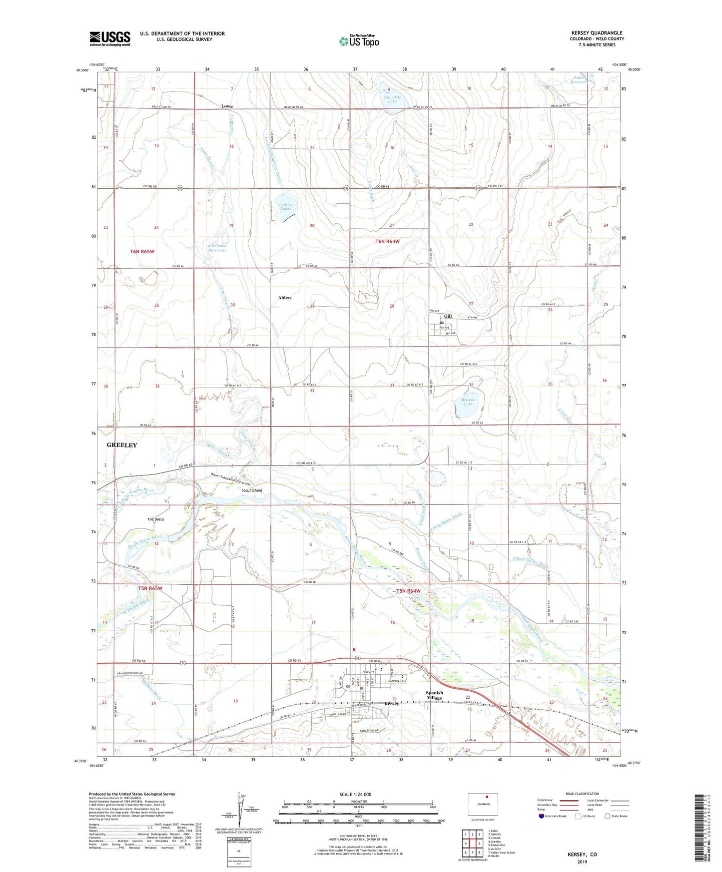
2022 topographic map quadrangle Kersey in the state of Colorado. Scale: 1:24000. Based on the newly updated USGS 7.5' US Topo map series, this map is in the following counties: Weld. The map contains contour data, water features, and other items you are used to seeing on USGS maps, but also has updated roads and other features. This is the next generation of topographic maps. Printed on high-quality waterproof paper with UV fade-resistant inks.
Quads adjacent to this one:
West: Greeley
Northwest: Eaton
North: Galeton
Northeast: Cornish
East: Barnesville
Southeast: Hardin
South: Valley View School
Southwest: La Salle
This map covers the same area as the classic USGS quad with code o40104d5.
Contains the following named places: Alden, Briscoe Lake, Briscoe Lake Dam, Cache la Poudre River, Cockroft Dairy Farms, Darling Ranch, Faber Reservoir, Galeton Dairy, Gill, Gill Post Office, Hoover Ditch, Horizon Vue Dairy, Horton Feedlot, Howards Lake, J B Cooke Dam, J B Cooke Reservoir, Kerbs Dairy, Kersey, Kersey Police Department, Kersey Post Office, Kuner Feedlot, Latham Ditch, Lindies Lakes, Lone Tree Creek, Lone Tree School, Longs Lateral Ditch, Lowe, North Fork Ogilvy Ditch, Owl Creek, Peter Brown School, Platte Valley Fire Protection District, Pleasant Valley, Plumb Ditch, Producer's Feedlot, Scout Island, South Fork Ogilvy Ditch, Spanish Village, Stout Dairy, The Delta, Town of Kersey, Willow Creek