MyTopo
Gem Village Colorado US Topo Map
Couldn't load pickup availability
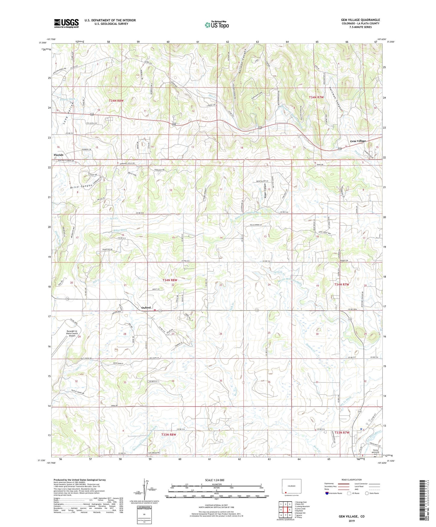
2022 topographic map quadrangle Gem Village in the state of Colorado. Scale: 1:24000. Based on the newly updated USGS 7.5' US Topo map series, this map is in the following counties: La Plata. The map contains contour data, water features, and other items you are used to seeing on USGS maps, but also has updated roads and other features. This is the next generation of topographic maps. Printed on high-quality waterproof paper with UV fade-resistant inks.
Quads adjacent to this one:
West: Loma Linda
Northwest: Durango East
North: Rules Hill
Northeast: Ludwig Mountain
East: Bayfield
Southeast: Tiffany
South: Ignacio
Southwest: Bondad Hill
This map covers the same area as the classic USGS quad with code o37107b6.
Contains the following named places: Brice Canyon, Chieftan Memorial, Doctor Morrison Ditch, Gem Village, Hartman Canyon, Holman Canyon, King Consolidated Ditch, Long Hollow, Los Pinos Fire Protection District Station 2 - Oxford, Morrison Consolidated Ditch, Ouray Memorial Cemetery, Oxford, Pioneer Ditch, Ridge Ditch, Southern Ute Agency, Southern Ute Police Department, Tri State Care Flight, Ute Park, Yeager Canyon