MyTopo
Loma Linda Colorado US Topo Map
Couldn't load pickup availability
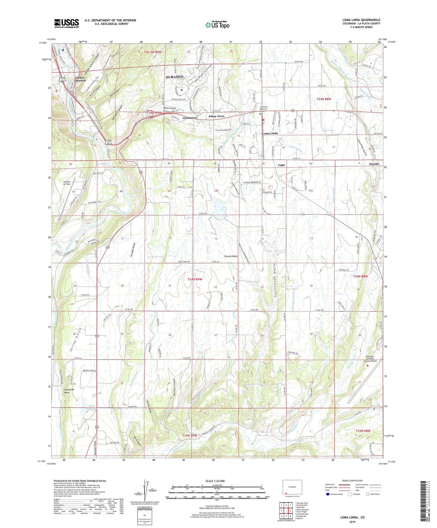
2022 topographic map quadrangle Loma Linda in the state of Colorado. Scale: 1:24000. Based on the newly updated USGS 7.5' US Topo map series, this map is in the following counties: La Plata. The map contains contour data, water features, and other items you are used to seeing on USGS maps, but also has updated roads and other features. This is the next generation of topographic maps. Printed on high-quality waterproof paper with UV fade-resistant inks.
Quads adjacent to this one:
West: Basin Mountain
Northwest: Durango West
North: Durango East
Northeast: Rules Hill
East: Gem Village
Southeast: Ignacio
South: Bondad Hill
Southwest: Long Mountain
This map covers the same area as the classic USGS quad with code o37107b7.
Contains the following named places: Animas Air Park, Animas Air Park Heliport, Animas Surgical Hospital, Axis Health System Crossroads at Grandview, Big Canyon, Carbon Junction, Carbon Junction Canyon, Cedar Lateral, Charles Lemon RR Dam, Charles Lemon RR Reservoir, Coop Ditch, Cottonwood Gulch, Cottonwood Lateral, Crestview Memorial Garden, Dry Creek, Durango - La Plata County Airport Fire Department, Durango Fire and Rescue Authority Station 1 - Bodo Park Station, Durango Fire Protection District - Station 7, Durango-La Plata County Airport, East Mesa Ditch, Falfa, Florida, Florida Farmers Ditch, Florida Mesa Elementary School, Gold Prince Mine, Grandview, Griffth, Ignacio Plant, KIUP-AM (Durango), Loma Linda, Lone Pine Gulch, McClure Murray Ditch, Mercy Regional Medical Center, Pastorius Dam, Pastorius Reservoir, Phillips Canyon, Pine Gulch, Pine Lateral, Pinon Acres, R E A Canyon, Sale Barn Canyon, Salt Creek, Short Dam, Short Reservoir, Sunnyside Mesa, Sutton Draw, Teti Canyon, West Fork Cottonwood Gulch, Wilson Gulch