MyTopo
Bondad Hill Colorado US Topo Map
Couldn't load pickup availability
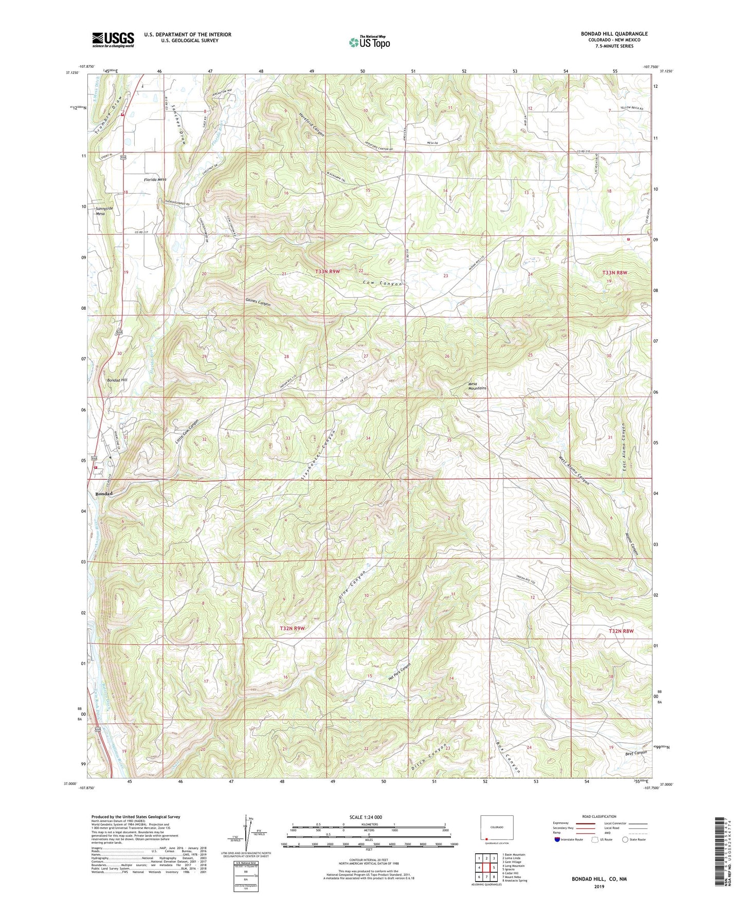
2022 topographic map quadrangle Bondad Hill in the state of Colorado. Scale: 1:24000. Based on the newly updated USGS 7.5' US Topo map series, this map is in the following counties: La Plata, San Juan. The map contains contour data, water features, and other items you are used to seeing on USGS maps, but also has updated roads and other features. This is the next generation of topographic maps. Printed on high-quality waterproof paper with UV fade-resistant inks.
Quads adjacent to this one:
West: Long Mountain
Northwest: Basin Mountain
North: Loma Linda
Northeast: Gem Village
East: Ignacio
Southeast: Anastacio Spring
South: Mount Nebo
Southwest: Cedar Hill
Contains the following named places: Bondad Hill, Bondad Landfill, Cow Canyon, Durango Fire and Rescue Authority Station 11 - Bondad Station, Durango Fire Protection District - Station 4, East Alamo Canyon, Finney Cuts, Florida River, Gaines Canyon, Hat Park Canyon, Hereford Canyon, Little Cow Canyon, Los Pinos Fire Protection District Station 3, Mesa Mountains, S and M Canal, Sanchez Draw, Sixshooter Canyon, Sunnyside Elementary School, West Alamo Canyon