MyTopo
Ignacio Colorado US Topo Map
Couldn't load pickup availability
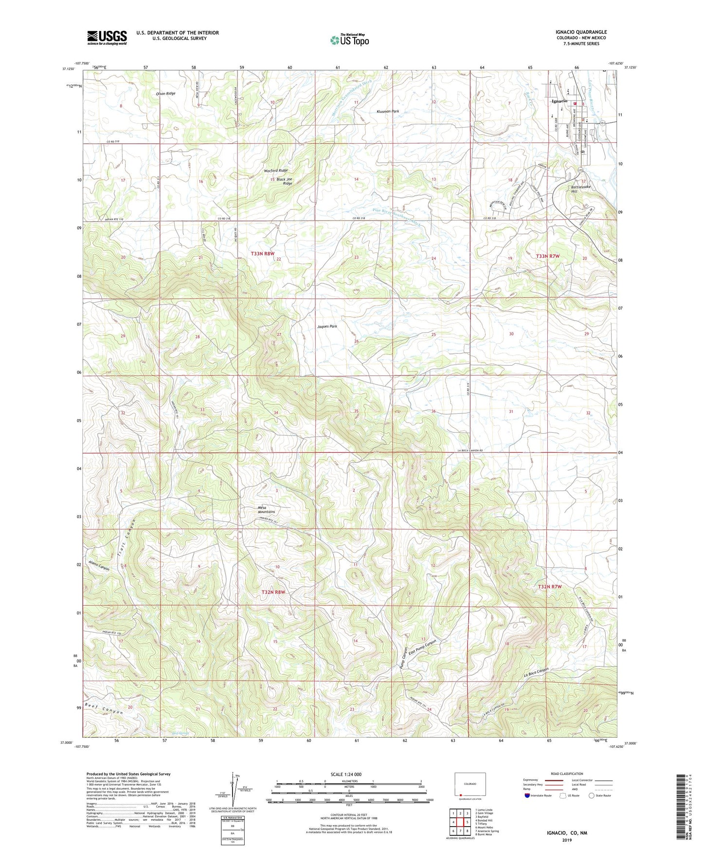
2022 topographic map quadrangle Ignacio in the state of Colorado. Scale: 1:24000. Based on the newly updated USGS 7.5' US Topo map series, this map is in the following counties: La Plata, San Juan. The map contains contour data, water features, and other items you are used to seeing on USGS maps, but also has updated roads and other features. This is the next generation of topographic maps. Printed on high-quality waterproof paper with UV fade-resistant inks.
Quads adjacent to this one:
West: Bondad Hill
Northwest: Loma Linda
North: Gem Village
Northeast: Bayfield
East: Tiffany
Southeast: Burnt Mesa
South: Anastacio Spring
Southwest: Mount Nebo
Contains the following named places: Alamo Canyon, Black Joe Ridge, East Pump Canyon, Ignacio, Ignacio Creek, Ignacio Police Department, Ignacio Post Office, Jaques Park, Klusman Park, KSUT-FM (Ignacio), Los Pinos Fire Protection District, Olson Ridge, Pine River Southwest Ditch, Rattlesnake Hill, Rock Creek, Southern Ute Reservation, Town of Ignacio, Worford Ridge