MyTopo
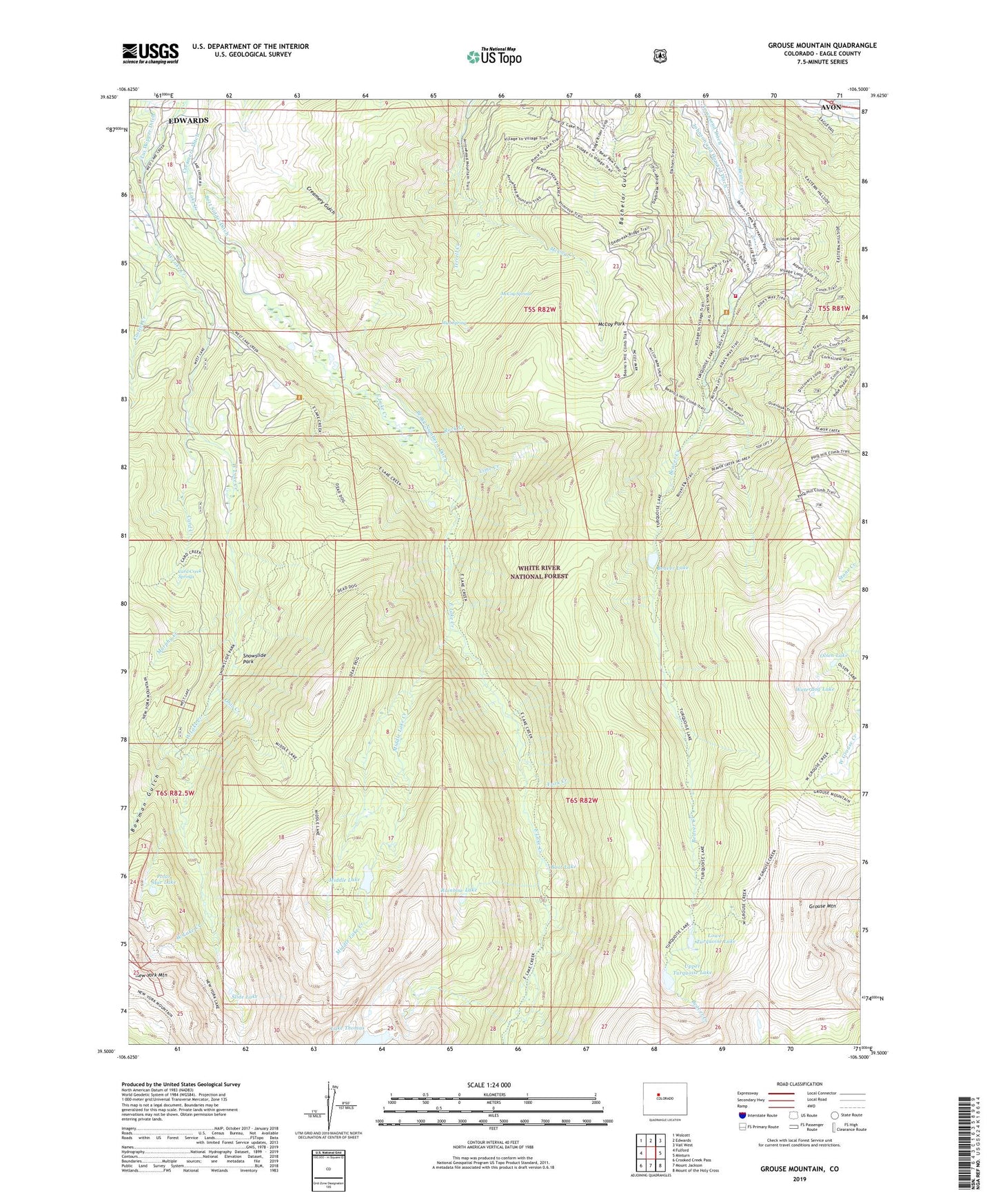
Grouse Mountain Colorado US Topo Map
Couldn't load pickup availability
Also explore the Grouse Mountain Forest Service Topo of this same quad for updated USFS data
2022 topographic map quadrangle Grouse Mountain in the state of Colorado. Scale: 1:24000. Based on the newly updated USGS 7.5' US Topo map series, this map is in the following counties: Eagle. The map contains contour data, water features, and other items you are used to seeing on USGS maps, but also has updated roads and other features. This is the next generation of topographic maps. Printed on high-quality waterproof paper with UV fade-resistant inks.
Quads adjacent to this one:
West: Fulford
Northwest: Wolcott
North: Edwards
Northeast: Vail West
East: Minturn
Southeast: Mount of the Holy Cross
South: Mount Jackson
Southwest: Crooked Creek Pass
This map covers the same area as the classic USGS quad with code o39106e5.
Contains the following named places: Avon Mine, Bachelor Gulch Village, Baryeta Cabins, Beaver Creek Golf Club, Beaver Creek Resort, Beaver Creek Village, Beaver Lake, Bert Siddel Ditch, Boot Lake, Bowman Gulch, Bragg Number 1 Ditch, Card Creek, Card Creek Springs, Casteel Creek, Eagle River Fire Protection District Station 11 Beaver Creek, East Lake Creek, Edwards Census Designated Place, Grouse Mountain, Johnson and Howard Ditch, Lake Thomas, Lime Creek, Lower Turquoise Lake, Lui Hopper Ditch, McCoy Park, McCoy Spring, Middle Lake, Middle Lake Creek, Mud Spring, Murphy Creek, New York Mountain, Ohio Creek, Ohio Tunnel, Olsen Lake, Polar Star Lake, Rainbow Lake, Rock Creek, Slide Lake, Snowslide Park, Terrell Creek, Townsend Ditch, Upper Turquoise Lake, Waterdog Lake, West Lake Creek, York Creek, ZIP Code: 81620