MyTopo
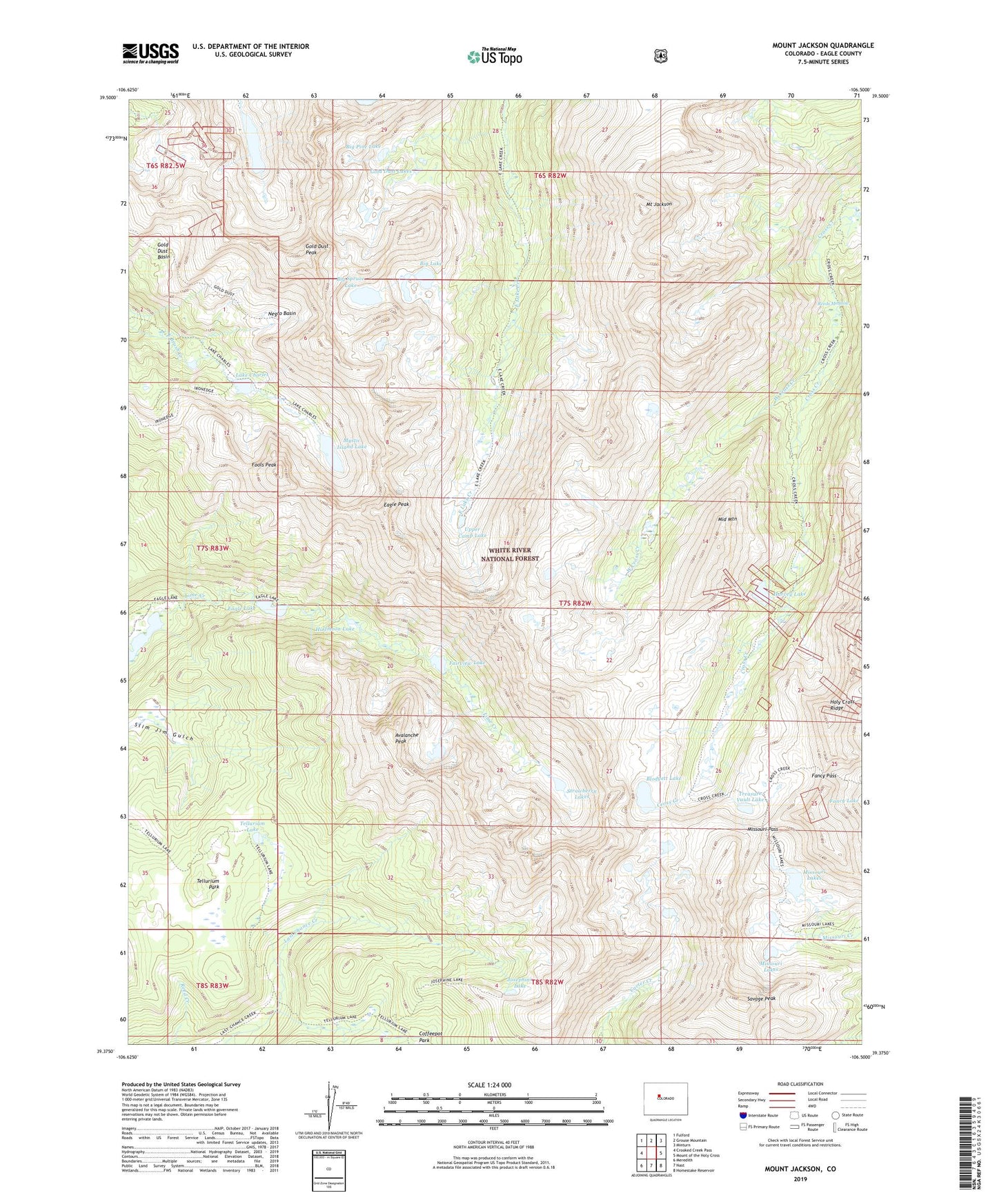
Mount Jackson Colorado US Topo Map
Couldn't load pickup availability
Also explore the Mount Jackson Forest Service Topo of this same quad for updated USFS data
2022 topographic map quadrangle Mount Jackson in the state of Colorado. Scale: 1:24000. Based on the newly updated USGS 7.5' US Topo map series, this map is in the following counties: Eagle. The map contains contour data, water features, and other items you are used to seeing on USGS maps, but also has updated roads and other features. This is the next generation of topographic maps. Printed on high-quality waterproof paper with UV fade-resistant inks.
Quads adjacent to this one:
West: Crooked Creek Pass
Northwest: Fulford
North: Grouse Mountain
Northeast: Minturn
East: Mount of the Holy Cross
Southeast: Homestake Reservoir
South: Nast
Southwest: Meredith
This map covers the same area as the classic USGS quad with code o39106d5.
Contains the following named places: Avalanche Peak, Big Lake, Big Pine Lake, Big Spruce Lake, Blodgett Lake, Eagle Lake, Eagle Peak, Fairview Lake, Fancy Pass, Fools Peak, Gold Dust Basin, Gold Dust Lakes, Gold Dust Peak, Halfmoon Lake, Harvey Lake, Holy Cross Wilderness, Horseshoe Lake, Josephine Lake, Lake Charles, Middle Mountain, Missouri Lakes, Missouri Pass, Mount Jackson, Mystic Island Lake, Negro Basin, New York Lake, Reeds Meadow, Savage Peak, Strawberry Lakes, Tellurium Lake, Tellurium Park, Treasure Vault Lake, Upper Camp Lake, West Cross Creek