MyTopo
Crooked Creek Pass Colorado US Topo Map
Couldn't load pickup availability
Also explore the Crooked Creek Pass Forest Service Topo of this same quad for updated USFS data
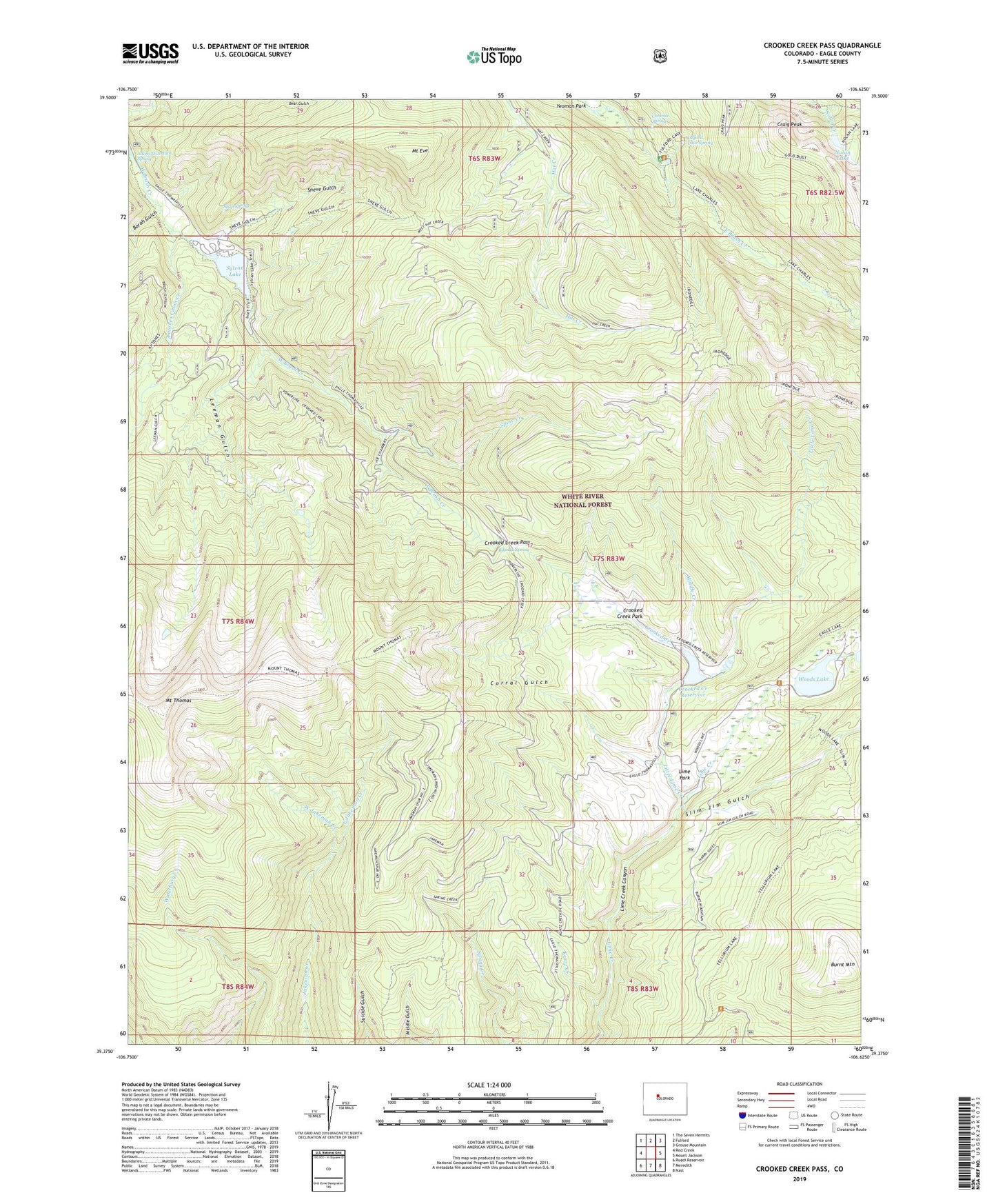
2022 topographic map quadrangle Crooked Creek Pass in the state of Colorado. Scale: 1:24000. Based on the newly updated USGS 7.5' US Topo map series, this map is in the following counties: Eagle. The map contains contour data, water features, and other items you are used to seeing on USGS maps, but also has updated roads and other features. This is the next generation of topographic maps. Printed on high-quality waterproof paper with UV fade-resistant inks.
Quads adjacent to this one:
West: Red Creek
Northwest: The Seven Hermits
North: Fulford
Northeast: Grouse Mountain
East: Mount Jackson
Southeast: Nast
South: Meredith
Southwest: Ruedi Reservoir
This map covers the same area as the classic USGS quad with code o39106d6.
Contains the following named places: Adam Campground, Adam Mountain Spring, Alicia Lake Dam, Alicia Lake Reservoir, Antone Trail, Antones Cabin Creek, Billings Spring, Borah Gulch, Burnt Mountain, Caliente Spring, Corral Gulch, Craig Peak, Crooked Creek, Crooked Creek Dam, Crooked Creek Park, Crooked Creek Pass, Crooked Creek Reservoir, East Jakeman Creek, Fulford Cave Campground, Fulford Cave Spring, Fulford Mine, Ironedge Trail, Kuntz Creek, Lake Charles Trail, Leeman Gulch, Leeman Lakes, Lime Park, Little Lime Creek, Middle Creek, Mount Eve, Mount Thomas, Nolan Lake, O-Z Dam, Slim Jim Gulch, Sneve Gulch, Soap Spring, Spine Creek, Sylvan Lake, West Jakeman Creek, Woods Lake