MyTopo
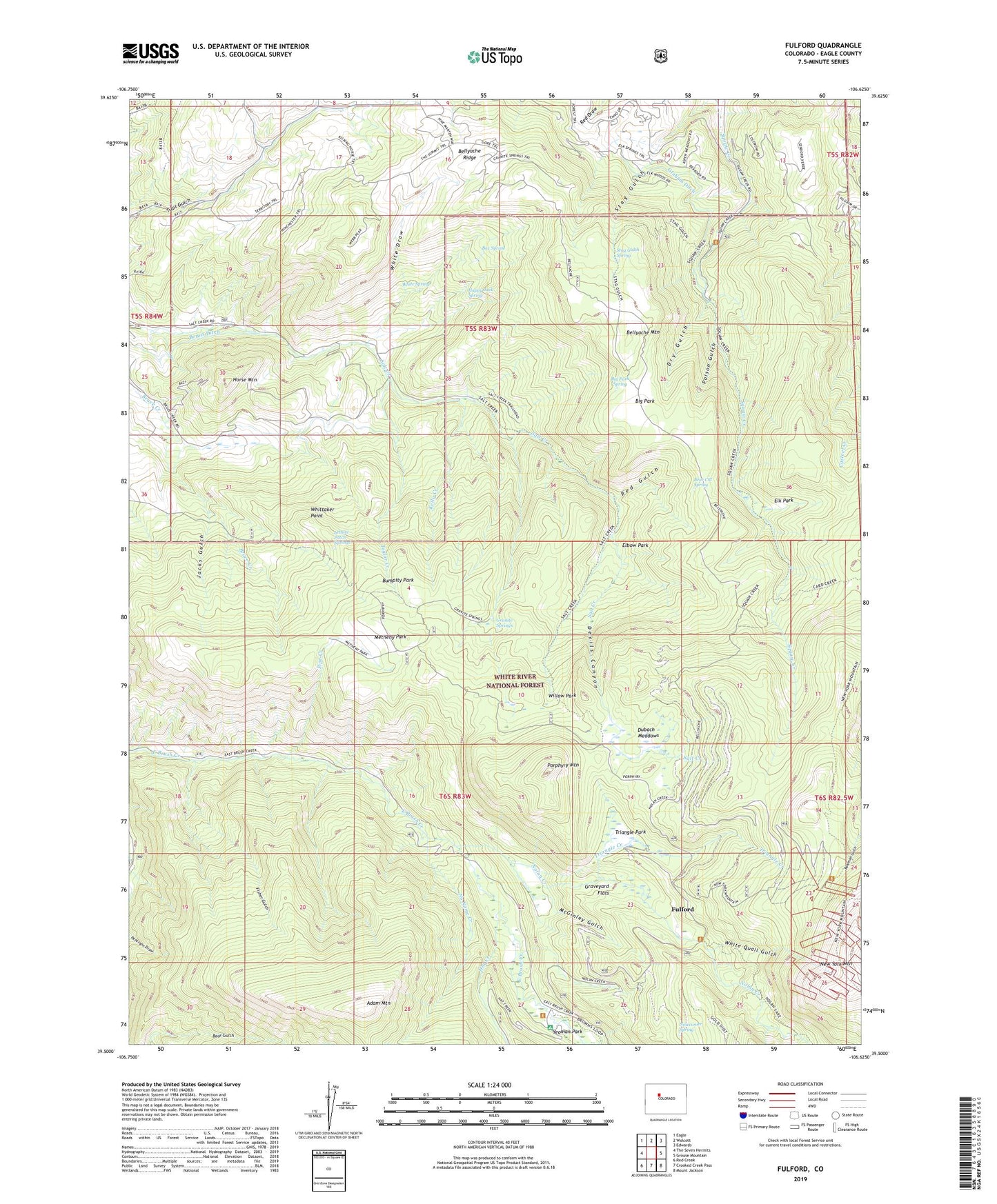
Fulford Colorado US Topo Map
Couldn't load pickup availability
Also explore the Fulford Forest Service Topo of this same quad for updated USFS data
2023 topographic map quadrangle Fulford in the state of Colorado. Scale: 1:24000. Based on the newly updated USGS 7.5' US Topo map series, this map is in the following counties: Eagle. The map contains contour data, water features, and other items you are used to seeing on USGS maps, but also has updated roads and other features. This is the next generation of topographic maps. Printed on high-quality waterproof paper with UV fade-resistant inks.
Quads adjacent to this one:
West: The Seven Hermits
Northwest: Eagle
North: Wolcott
Northeast: Edwards
East: Grouse Mountain
Southeast: Mount Jackson
South: Crooked Creek Pass
Southwest: Red Creek
This map covers the same area as the classic USGS quad with code o39106e6.
Contains the following named places: Adam Mountain, At Last Mine, Bear Cat Spring, Bellyache Mountain, Bemis Ditch, Big Park, Big Park Spring, Box Spring, Bumpity Park, Devils Canyon, Dry Gulch, Dubach Meadows, Elbow Park, Elk Park, Fisher Gulch, Fulford, Fulford Census Designated Place, Graham Ditch, Granite Springs, Graveyard Flats, Happy Jack Spring, Hat Creek, Horse Mountain, Jacks Gulch, Johnson Mine, Kelly Creek, Lady Belle Mine, Lake Creek Trail, Lettuce Patch Springs, McGinley Gulch, Metheny Park, New York Mountain Trail, Newcomer Spring, No Name Creek, Nolan Creek, North Dakota Mine, Pipe Creek, Poison Gulch, Polar Star Mine, Porphyry Mountain, Red Gulch, Salt Creek, Salt Creek Trail, Stag Gulch Spring, Taylor Creek, Triangle Creek, Triangle Park, Triangle Reservoir, White Draw, White Quail Gulch, White Spring, Whittaker Point, Willow Park, Yeoman Park, Yeoman Park Campground