MyTopo
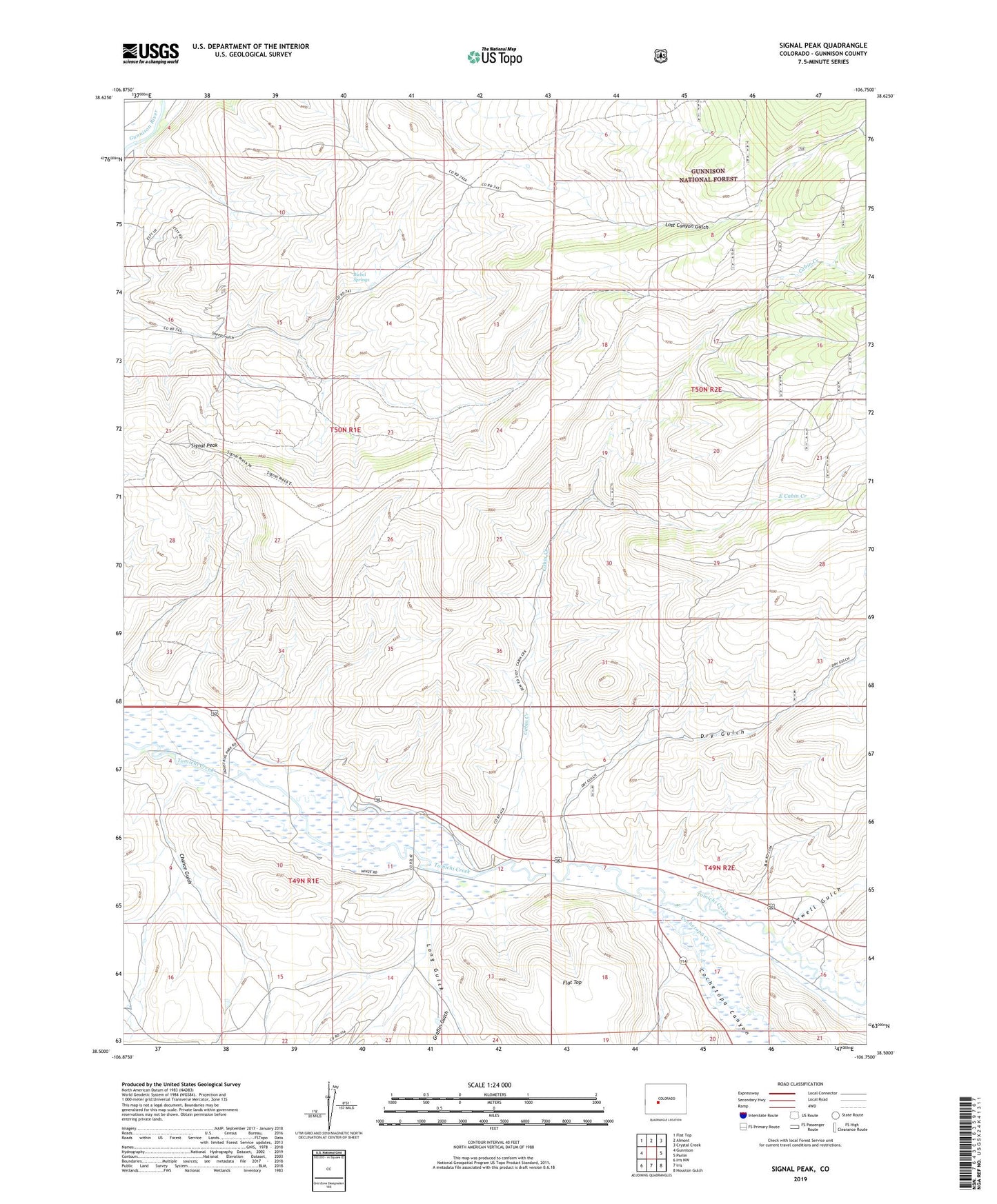
Signal Peak Colorado US Topo Map
Couldn't load pickup availability
Also explore the Signal Peak Forest Service Topo of this same quad for updated USFS data
2022 topographic map quadrangle Signal Peak in the state of Colorado. Scale: 1:24000. Based on the newly updated USGS 7.5' US Topo map series, this map is in the following counties: Gunnison. The map contains contour data, water features, and other items you are used to seeing on USGS maps, but also has updated roads and other features. This is the next generation of topographic maps. Printed on high-quality waterproof paper with UV fade-resistant inks.
Quads adjacent to this one:
West: Gunnison
Northwest: Flat Top
North: Almont
Northeast: Crystal Creek
East: Parlin
Southeast: Houston Gulch
South: Iris
Southwest: Iris NW
This map covers the same area as the classic USGS quad with code o38106e7.
Contains the following named places: Biebel Springs, Cabin Creek, Chance Gulch, Cochetopa Canyon, Cochetopa Creek, Dry Gulch, East Cabin Creek, Graflin Gulch, Long Gulch, Sewell Gulch, Signal Peak