
MyTopo
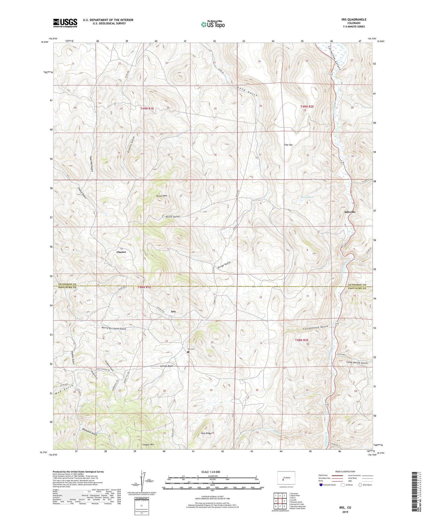
Iris Colorado US Topo Map
Couldn't load pickup availability
Also explore the Iris Forest Service Topo of this same quad for updated USFS data
2022 topographic map quadrangle Iris in the state of Colorado. Scale: 1:24000. Based on the newly updated USGS 7.5' US Topo map series, this map is in the following counties: Gunnison, Saguache. The map contains contour data, water features, and other items you are used to seeing on USGS maps, but also has updated roads and other features. This is the next generation of topographic maps. Printed on high-quality waterproof paper with UV fade-resistant inks.
Quads adjacent to this one:
West: Iris NW
Northwest: Gunnison
North: Signal Peak
Northeast: Parlin
East: Houston Gulch
Southeast: Razor Creek Dome
South: Sawtooth Mountain
Southwest: Spring Hill Creek
This map covers the same area as the classic USGS quad with code o38106d7.
Contains the following named places: Balls Lode Mine, Barrel Spring, Bead Creek, Black Cat Mine, Blackjack Gulch, Camp Kettle Gulch, Chance, Cottonwood Gulch, Denver City Mine, Dirigo Gulch, Dutch Gulch, Flat Top, Flick Homestead, Freeman Group Mine, Grayback Gulch, Green Mountain, Hathaway Mine, Iris, Iris Cemetery, Jones Homestead, Kline Homestead, Kreuger Ranch, Lucky Strike Mine, Lula Mine, Maple Leaf Mine, Meadow Gulch, Merry-go-round Gulch, Mick Homestead, Mineral Hill Mine, Mitchell Ranch, Mud Gulch, Post Homestead, Post Ridge, Sage Hen Gulch, Schisto Basin, Sillsville, Yukon Mine


