MyTopo
Naturita Colorado US Topo Map
Couldn't load pickup availability
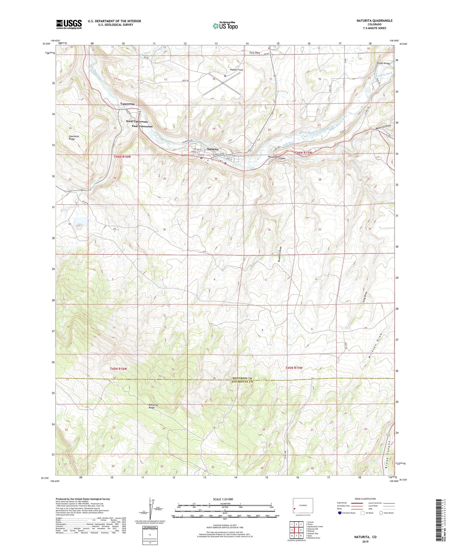
2022 topographic map quadrangle Naturita in the state of Colorado. Scale: 1:24000. Based on the newly updated USGS 7.5' US Topo map series, this map is in the following counties: Montrose, San Miguel. The map contains contour data, water features, and other items you are used to seeing on USGS maps, but also has updated roads and other features. This is the next generation of topographic maps. Printed on high-quality waterproof paper with UV fade-resistant inks.
Quads adjacent to this one:
West: Naturita NW
Northwest: Uravan
North: Nucla
Northeast: Big Bucktail Creek
East: Redvale
Southeast: Barkelew Draw
South: Basin
Southwest: Gypsum Gap
This map covers the same area as the classic USGS quad with code o38108b5.
Contains the following named places: Annie Mine, April Mine, Bay State Mine, BCD Ditch, Bramiers Draw, Broad Canyon, Brooks Bridge, Cummings Mine, Dry Creek, East Vancorum, Emma Mine, Fiddling Bill Mine, First Park, Hamilton Creek, Hopkins Field, Lexington Mine, Long Draw, Mary Ann Mine, Maverick Draw, Montrose County Sheriff's Office - West End, Naturita, Naturita Canyon, Naturita Creek, Naturita Post Office, Naturita Ridge, Nucla - Naturita Fire Department Station 2, Philadelphia Mine, Reed-Chatfield Ditch, Republican Mine, Rose Mine, Simplot Mine, Town of Naturita, Ute Mine, Vanadite Mine, Vancorum, West Vancorum, Woods Placer Group Mine, Woods Placer Mine