MyTopo
Naturita NW Colorado US Topo Map
Couldn't load pickup availability
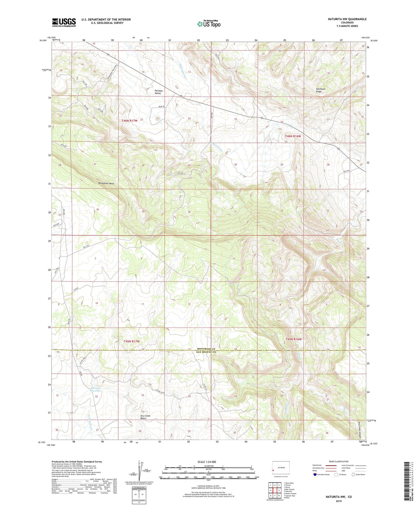
2022 topographic map quadrangle Naturita NW in the state of Colorado. Scale: 1:24000. Based on the newly updated USGS 7.5' US Topo map series, this map is in the following counties: Montrose, San Miguel. The map contains contour data, water features, and other items you are used to seeing on USGS maps, but also has updated roads and other features. This is the next generation of topographic maps. Printed on high-quality waterproof paper with UV fade-resistant inks.
Quads adjacent to this one:
West: Bull Canyon
Northwest: Davis Mesa
North: Uravan
Northeast: Nucla
East: Naturita
Southeast: Basin
South: Gypsum Gap
Southwest: Hamm Canyon
This map covers the same area as the classic USGS quad with code o38108b6.
Contains the following named places: Black Eagle Mine, BTM Claim Group Mine, Corral Number 2, Deer Shaft Mine, Dry Creek Canyon, J.J. Mine, Lone Cedar Mine, Maybe Mine, Mineral Joe Group Mine, Mineral Joe Number Two Mine, Monogram Mesa, Nil Number Two Mine, Nil-Trace Group Mines, Paradox D Mine, Paradox Number Four Mine, Rigel Mine, Spectacle Reservoir, Thunderbolt Mine, West Fork Dry Creek