MyTopo
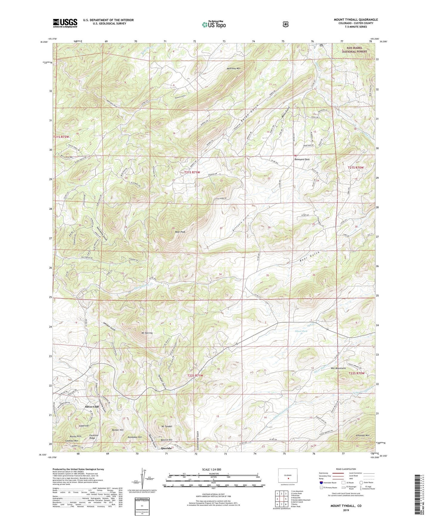
Mount Tyndall Colorado US Topo Map
Couldn't load pickup availability
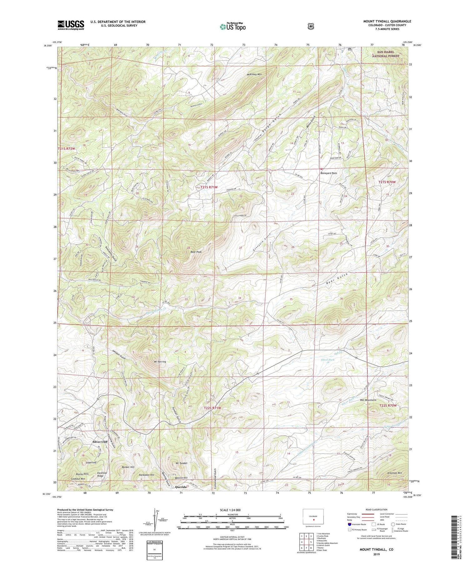
Also explore the Mount Tyndall Forest Service Topo of this same quad for updated USFS data
2022 topographic map quadrangle Mount Tyndall in the state of Colorado. Scale: 1:24000. Based on the newly updated USGS 7.5' US Topo map series, this map is in the following counties: Custer. The map contains contour data, water features, and other items you are used to seeing on USGS maps, but also has updated roads and other features. This is the next generation of topographic maps. Printed on high-quality waterproof paper with UV fade-resistant inks.
Quads adjacent to this one:
West: Westcliffe
Northwest: Iron Mountain
North: Curley Peak
Northeast: Rockvale
East: Hardscrabble Mountain
Southeast: Deer Peak
South: Rosita
Southwest: Aldrich Gulch
This map covers the same area as the classic USGS quad with code o38105b3.
Contains the following named places: Antrim Claim, Armstrong Ranch, Bassick Hill, Bassick Mine, Bear Peak, Big Stake Nickel Mine, Boneyard Gulch, Boneyard Park, Brush Hollow Creek, Bunker Hill, Cottonwood Gulch, Derby Extension Mine, Dry Lake, Dry Lake School, Excelsior Ridge, Feldspar Lode, General Ike Mine, Georgia Mine, Haputa Ranch Mine, John Spalding Mine, Jones Ranch, Kankakee Hill, Kness Ranch, Lee Jones Ranch Mine, Lookout Mountain, Lucky Find Mine, Lucky Strike Mine, Mains Gulch, McKenzie Ranch, McKinley Mountain, Mount Herring, Mount Tyndall, Mystery Mine, Nightingale Claim, Oak Creek Mine, Penny Poker Mine, Pocahontas Mine, Querida, Querida Gulch, Robinson-Young-Marjorie Lode Mine, Silver Park, Sparling Ranch Mine, Starbuck Mine, Sugarloaf, Tenmile Gulch, Thorium Mountain Mine, Tomsick Mine, Tomsick Ranch, Tyndall Gulch, Wet Mountain Fire Protection District - Boneyard Park Station, Wet Mountain Mine