MyTopo
Sun Valley Ranch Colorado US Topo Map
Couldn't load pickup availability
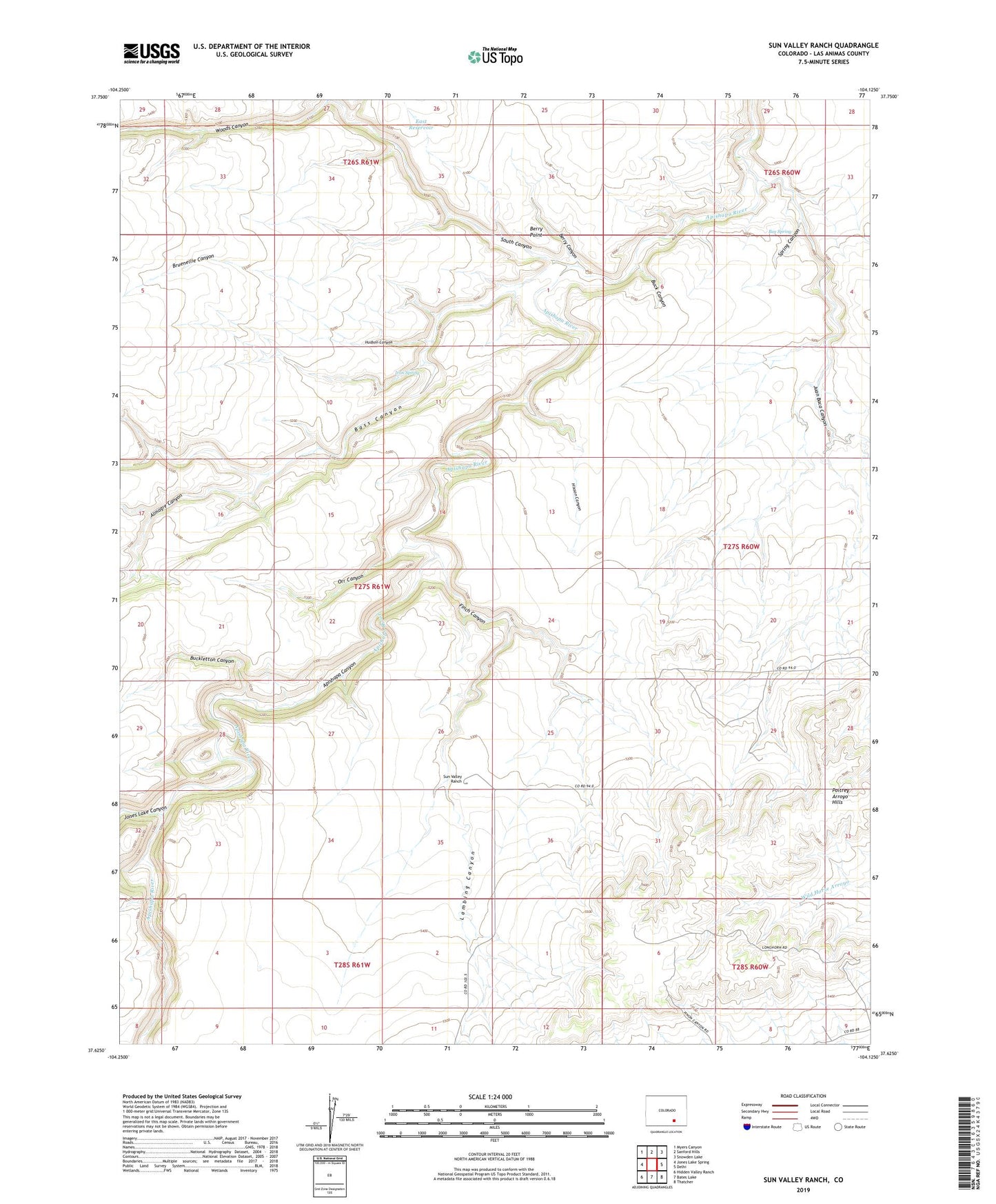
2022 topographic map quadrangle Sun Valley Ranch in the state of Colorado. Scale: 1:24000. Based on the newly updated USGS 7.5' US Topo map series, this map is in the following counties: Las Animas. The map contains contour data, water features, and other items you are used to seeing on USGS maps, but also has updated roads and other features. This is the next generation of topographic maps. Printed on high-quality waterproof paper with UV fade-resistant inks.
Quads adjacent to this one:
West: Jones Lake Spring
Northwest: Myers Canyon
North: Sanford Hills
Northeast: Snowden Lake
East: Delhi
Southeast: Thatcher
South: Bates Lake
Southwest: Hidden Valley Ranch
This map covers the same area as the classic USGS quad with code o37104f2.
Contains the following named places: Almagre Canyon, Apishapa Canyon, Bass Canyon, Berry Canyon, Berry Point, Box Spring, Bruenellie Canyon, Bruenellie Windmill, Buck Canyon, Buckletton Canyon, East Reservoir, Finch Canyon, Hixson Canyon, Hixson Windmill, Hudson Canyon, Iron Spring, Jones Lake Canyon, Juan Baca Canyon, Lambing Canyon, Orr Canyon, Poitrey Arroyo Hills, South Canyon, Spring Canyon, West Fork Long Branch, Woods Canyon