MyTopo
Indian Hills Colorado US Topo Map
Couldn't load pickup availability
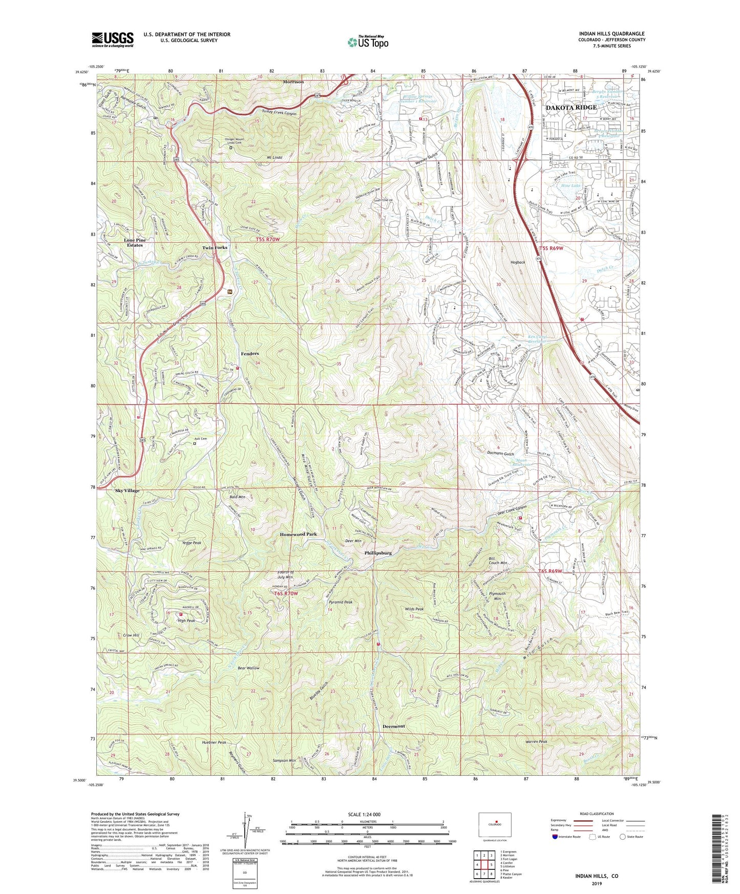
2022 topographic map quadrangle Indian Hills in the state of Colorado. Scale: 1:24000. Based on the newly updated USGS 7.5' US Topo map series, this map is in the following counties: Jefferson. The map contains contour data, water features, and other items you are used to seeing on USGS maps, but also has updated roads and other features. This is the next generation of topographic maps. Printed on high-quality waterproof paper with UV fade-resistant inks.
Quads adjacent to this one:
West: Conifer
Northwest: Evergreen
North: Morrison
Northeast: Fort Logan
East: Littleton
Southeast: Kassler
South: Platte Canyon
Southwest: Pine
This map covers the same area as the classic USGS quad with code o39105e2.
Contains the following named places: Ault Cemetery, Bald Mountain, Bear Wallow, Belleview Acres Park, Belleview Community Church, Bellevue Acres, Bergen Ditch, Bergen East Dam, Bergen East Reservoir, Bergen Number 4 Dam, Bergen Number 4 Reservoir, Bergen Number 5 Dam, Bergen Number 5 Reservoir, Bergen Park Pit, Bergen Reservoirs, Bergen West Dam, Bergen West Reservoir, Bigger Mica Mine, Bill Couch Mountain, Blackstone Claim Mine, Bluejay Gulch, Bradford K8 North, Bradford K8 South, Brannon Gearhart Park, Chatfield Senior High School, Church of Jesus Christ of Latter Day Saints, Coleman Gulch, Country West, Crow Hill, Dakota Ridge Assembly, Dakota Ridge Census Designated Place, Deer Creek Building Heliport, Deer Creek Canyon, Deer Creek Canyon Park, Deer Creek South Pit Quarry, Deer Mountain, Deermont, Docmann Gulch, Doubleheader Ranch, Fenders, Fourth of July Mountain, Gems Park Estates, Giant Gulch, Gilmore Chapel, Glen Plym Ditch Number 1, Golden Meadows, Heirloom Park, High Peak, Hine Lake, Homestead, Homewood Park, Huebner Peak, Independent Highline Ditch, Indian Hills, Indian Hills Post Office, Inter - Canyon Fire Protection District Station 1, Inter - Canyon Fire Protection District Station 2, Inter - Canyon Fire Protection District Station 3, Inter - Canyon Fire Protection District Station 4, Inter - Canyon Fire Protection District Station 5, Iowa Gulch, Iowa Gulch Pegmatite Mine, Ken Caryl Dam, Ken Caryl Ranch, Ken Caryl Ranch North, Ken Caryl Ranch Post Office, Ken Caryl Reservoir, King Fisher Lake Dam, King Fisher Lake Reservoir, KWBI-FM (Morrison), KWBI-TV (Denver), KXKL-FM (Denver), Little Deer Creek, Lone Pine Estates, Madlen School Pegmatites Mine, Mann Dam, Mann Reservoir, Mica Mine Gulch, Mill Creek, Mill Gulch, Mount Carbon Elementary School, Mount Lindo, Mountain High Chapel, Murphy Gulch, North Fork Deer Creek, North Ranch Park, North Turkey Creek, Olinger Mount Lindo Cemetery, Parmalee Gulch, Phillipsburg, Plymouth Creek, Plymouth Mountain, Polly A Deane Dam, Pyramid Peak, Rattlesnake Gulch, Red Rocks Country Club, Rock Products Number Two Quarry, Sampson Mountain, Sampson School, Sky Village, South Fork Deer Creek, South Turkey Creek, South Turkey Creek Community Center, South Valley Park, Switzers Gulch, The Bluffs, The Valley, Thomas-Union Lodes Pegmatite Mine, Tinker-Shaffer Dam, Tinker-Shaffer Reservoir, Tiny Town, Turkey Creek Canyon, Twin Forks, Union Mica Lode Mine, Valley Park, Van Alderstien Gulch, Warren Peak, Watson Gulch, West Meadows, West Metro Fire Rescue - Station 13, West Metro Fire Rescue Station 11, Western Bible Institute, Wildcat Gulch, Wilds Peak, Willow Brook, Willow Springs, Willow Springs Number 1 Dam, Willow Springs Number 1 Reservoir, Willow Springs Ranch, Willowbrook Arena, Yegge Peak, ZIP Codes: 80127, 80465