
MyTopo
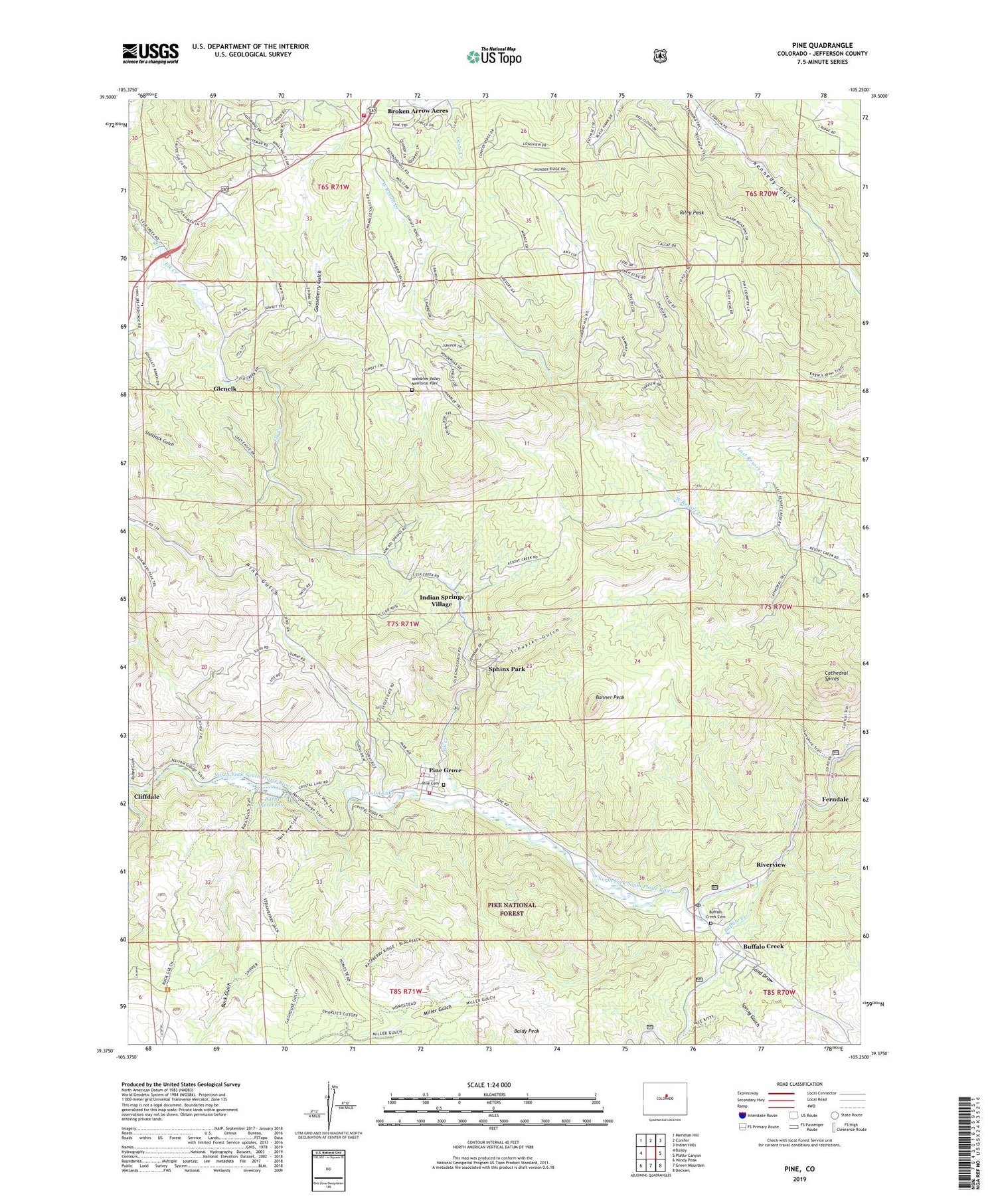
Pine Colorado US Topo Map
Couldn't load pickup availability
Also explore the Pine Forest Service Topo of this same quad for updated USFS data
2022 topographic map quadrangle Pine in the state of Colorado. Scale: 1:24000. Based on the newly updated USGS 7.5' US Topo map series, this map is in the following counties: Jefferson. The map contains contour data, water features, and other items you are used to seeing on USGS maps, but also has updated roads and other features. This is the next generation of topographic maps. Printed on high-quality waterproof paper with UV fade-resistant inks.
Quads adjacent to this one:
West: Bailey
Northwest: Meridian Hill
North: Conifer
Northeast: Indian Hills
East: Platte Canyon
Southeast: Deckers
South: Green Mountain
Southwest: Windy Peak
This map covers the same area as the classic USGS quad with code o39105d3.
Contains the following named places: Alpha Mine, Arlington Mine, Baehr Dam, Baehr Reservoir, Banner Peak, Barker Mine, Becky Sharp Mine, Buck Gulch, Buffalo Creek, Buffalo Creek Cemetery, Buffalo Creek Post Office, Buffalo Creek Work Center, Buffalo Mine, Cathedral Spires, Crystal Lake, Crystal Lake Dam, Elk Creek, Elk Creek Acres, Elk Creek Elementary School, Elk Creek Fire Protection District - Station 1, Elk Creek Fire Station, Ferndale, Glenelk, Gooseberry Gulch, Indian Springs Village, J Higginson Ditch, Luster Lode Quarry, Miller Gulch, North Fork Volunteer Fire Department Station 2, Osiris Property Mine, Pine Cemetery, Pine Grove, Pine Gulch, Raleigh Park Mine, Riley Peak, Riverview, Roland Gulch, Sand Draw, Schuyler Gulch, Shaffers Crossing, Shattuck Gulch, South Jefferson Division, Sphinx Park, Spring Gulch, Wamblee Valley Memorial Park, West Resort Creek, White Gap Quarry, ZIP Codes: 80433, 80470


