MyTopo
La Salle Colorado US Topo Map
Couldn't load pickup availability
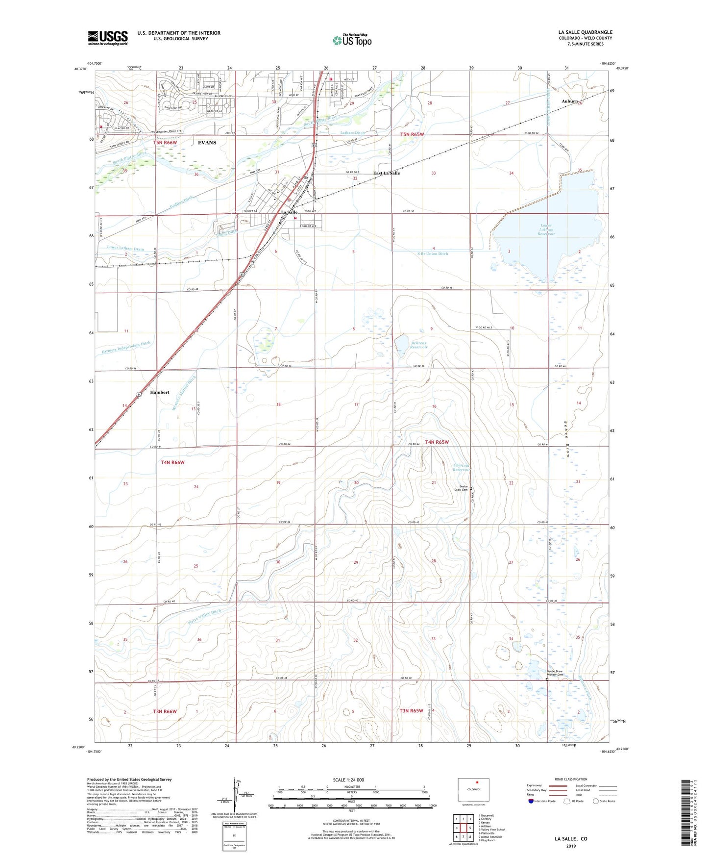
2022 topographic map quadrangle La Salle in the state of Colorado. Scale: 1:24000. Based on the newly updated USGS 7.5' US Topo map series, this map is in the following counties: Weld. The map contains contour data, water features, and other items you are used to seeing on USGS maps, but also has updated roads and other features. This is the next generation of topographic maps. Printed on high-quality waterproof paper with UV fade-resistant inks.
Quads adjacent to this one:
West: Milliken
Northwest: Bracewell
North: Greeley
Northeast: Kersey
East: Valley View School
Southeast: Klug Ranch
South: Milton Reservoir
Southwest: Platteville
This map covers the same area as the classic USGS quad with code o40104c6.
Contains the following named places: AJC Airport, Ashcroft Draw, Auburn, Bebee Draw, Bebee Draw Gun Club, Bebee Draw School, Beebe Draw Cemetery, Beebe Draw Pioneer Cemetery, Behrens Dam, Behrens Reservoir, Big Bend School, Chestnut Reservoir, Colorado State Patrol District 3 Northeast Colorado, East La Salle, Evans Fire Protection District Station 1, Evans Number 2 Ditch, Evans Town Ditch, Evens Number 2 Ditch, Godfrey Ditch, Hambert, KFKA-AM (Greeley), La Salle, La Salle Fire Department, La Salle Post Office, La Salle-Gilcrest Division, LaSalle Police Department, Lower Latham Dam, Lower Latham Drain, Lower Latham Outlet, Lower Latham Reservoir, Miller Feed Lots, Milliken Fire Protection District Station 2, South Branch Union Ditch, Town of La Salle, Union Ditch, ZIP Codes: 80620, 80645