MyTopo
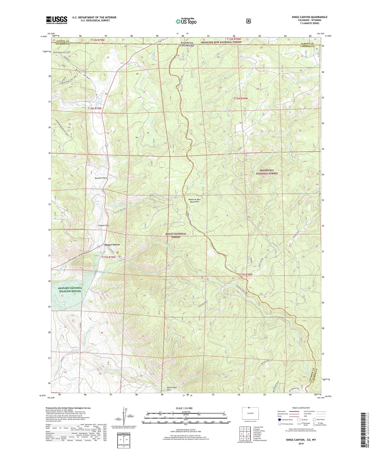
Kings Canyon Colorado US Topo Map
Couldn't load pickup availability
Also explore the Kings Canyon Forest Service Topo of this same quad for updated USFS data
2022 topographic map quadrangle Kings Canyon in the state of Colorado. Scale: 1:24000. Based on the newly updated USGS 7.5' US Topo map series, this map is in the following counties: Jackson, Larimer, Albany. The map contains contour data, water features, and other items you are used to seeing on USGS maps, but also has updated roads and other features. This is the next generation of topographic maps. Printed on high-quality waterproof paper with UV fade-resistant inks.
Quads adjacent to this one:
West: Northgate
Northwest: Horatio Rock
North: Foxpark
Northeast: Woods Landing
East: Old Roach
Southeast: Shipman Mountain
South: Eagle Hill
Southwest: Cowdrey
Contains the following named places: Allard Ditch, Bear Draw, Bluebird Park, Camp, Camp Nelson, Clayton Park, Clayton Rich Ditch, Government Ditch Number 2, Hardwork Ditch, Heidrich Creek, Kings Canyon, Kings Canyon Mine, Latter Ditch, Lawrence Creek, Little Government Creek, Village Belle Creek, Village Belle Mine