MyTopo
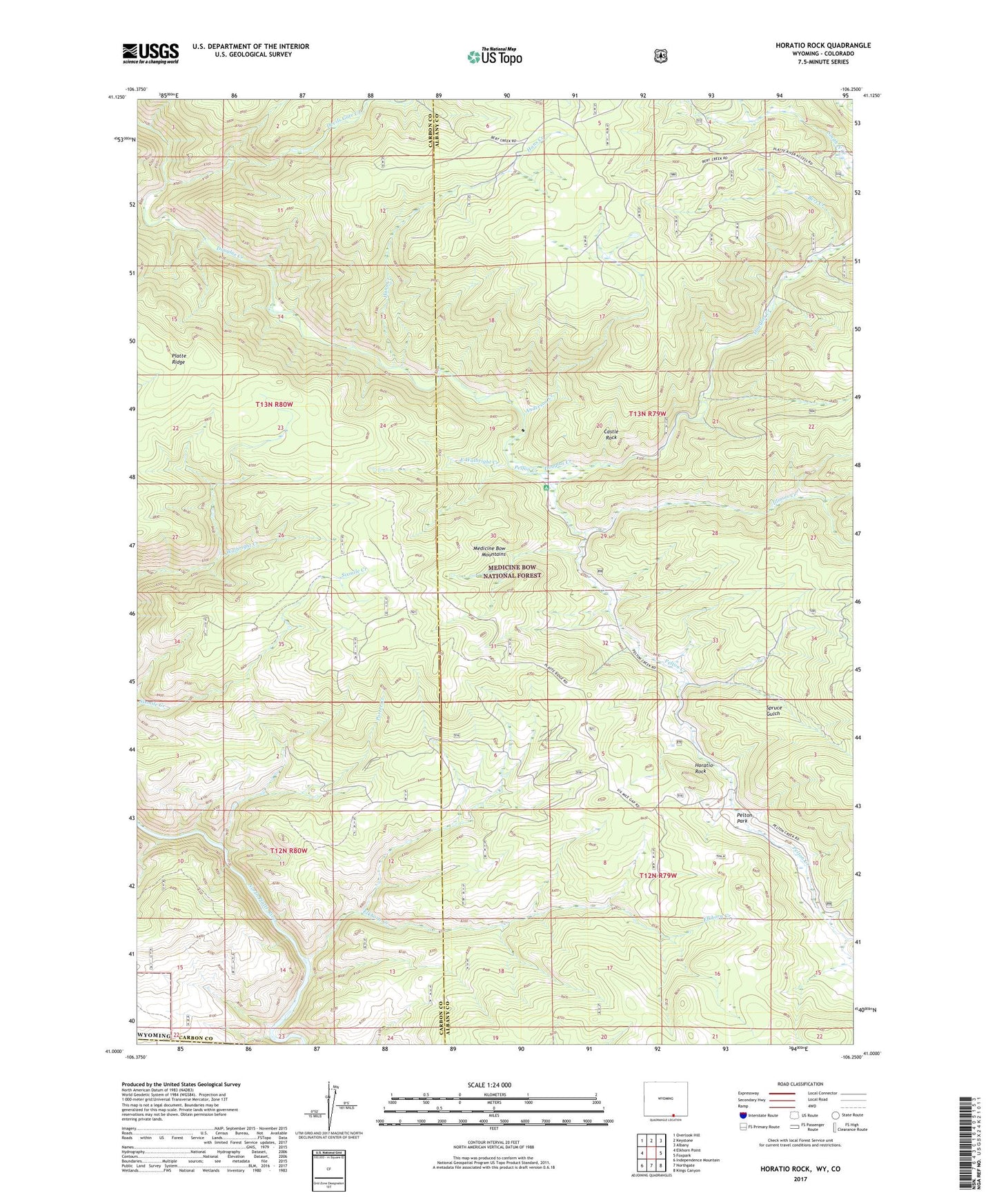
Horatio Rock Wyoming US Topo Map
Couldn't load pickup availability
Also explore the Horatio Rock Forest Service Topo of this same quad for updated USFS data
2021 topographic map quadrangle Horatio Rock in the state of Wyoming. Scale: 1:24000. Based on the newly updated USGS 7.5' US Topo map series, this map is in the following counties: Albany, Carbon, Jackson. The map contains contour data, water features, and other items you are used to seeing on USGS maps, but also has updated roads and other features. This is the next generation of topographic maps. Printed on high-quality waterproof paper with UV fade-resistant inks.
Quads adjacent to this one:
West: Elkhorn Point
Northwest: Overlook Hill
North: Keystone
Northeast: Albany
East: Foxpark
Southeast: Kings Canyon
South: Northgate
Southwest: Independence Mountain
This map covers the same area as the classic USGS quad with code o41106a3.
Contains the following named places: Anderson Creek, Bert Creek, Castle Rock, Devils Gate Creek, East Walbright Creek, Elkhorn Creek, Fairview Claim-Tenderfoot Mountain Mine, Hans Creek, Horatio Rock, Illinois Creek, Illinois Creek Campground, Lost Park, Magnolia Lode, Many Values Prospect, Mowberg Creek, Pelton Creek, Pelton Creek Campground, Pelton Creek Mine, Pelton Park, Porter Creek, Ropers Cabin, Spruce Gulch, West Fork Devils Gate Creek