MyTopo
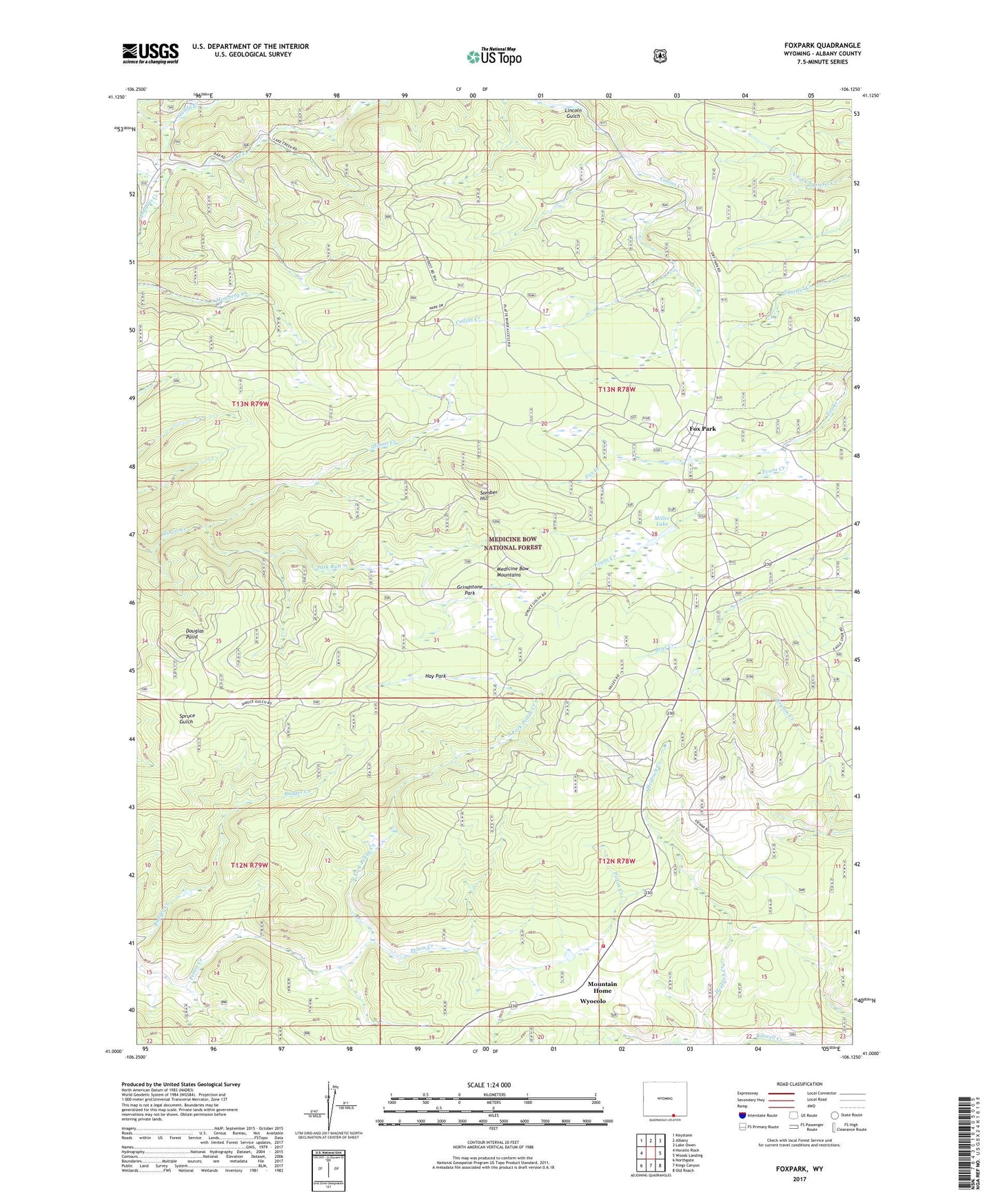
Foxpark Wyoming US Topo Map
Couldn't load pickup availability
Also explore the Foxpark Forest Service Topo of this same quad for updated USFS data
2021 topographic map quadrangle Foxpark in the state of Wyoming. Scale: 1:24000. Based on the newly updated USGS 7.5' US Topo map series, this map is in the following counties: Albany. The map contains contour data, water features, and other items you are used to seeing on USGS maps, but also has updated roads and other features. This is the next generation of topographic maps. Printed on high-quality waterproof paper with UV fade-resistant inks.
Quads adjacent to this one:
West: Horatio Rock
Northwest: Keystone
North: Albany
Northeast: Lake Owen
East: Woods Landing
Southeast: Old Roach
South: Kings Canyon
Southwest: Northgate
This map covers the same area as the classic USGS quad with code o41106a2.
Contains the following named places: American Mine, Badger Creek, Big Laramie Valley Volunteer Fire Department, Collins, Collins Creek, Dell Mine, Desert Rose Mine, Douglas Point, Evans Creek, Evans Creek Campground, Fox Park Census Designated Place, Foxpark, Foxpark Work Center, Gramm, Gramm Post Office, Grindstone Park, Hay Park, Ione Prospect, Kansas Group - Keystone Holmes Area Mine, Keystone Mine, Lake Creek, Lake Creek Mines, Lake Creek Resort, Lincoln Gulch, Maudem Group Mine, Miller Lake, Miller Lake Campground, Mountain Home, Muddy Creek, Muscovite Claim Mine, North Fork, North Fork Pelton Creek, Ox Yoke Ranch, Park Run, Porter Ranch, Roosevelt Camp, Smith North Creek, Somber Hill, Webbers Sawmill, Wyocolo