MyTopo
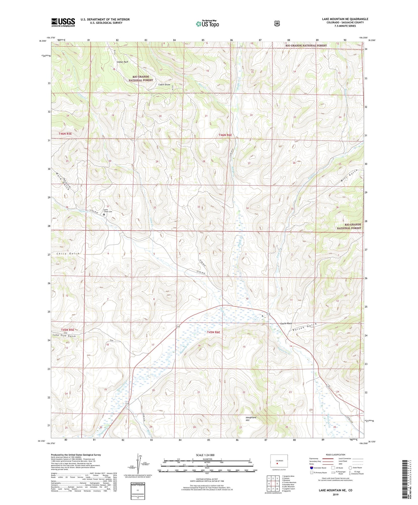
Lake Mountain NE Colorado US Topo Map
Couldn't load pickup availability
Also explore the Lake Mountain NE Forest Service Topo of this same quad for updated USFS data
2022 topographic map quadrangle Lake Mountain NE in the state of Colorado. Scale: 1:24000. Based on the newly updated USGS 7.5' US Topo map series, this map is in the following counties: Saguache. The map contains contour data, water features, and other items you are used to seeing on USGS maps, but also has updated roads and other features. This is the next generation of topographic maps. Printed on high-quality waterproof paper with UV fade-resistant inks.
Quads adjacent to this one:
West: Trickle Mountain
Northwest: Sargents Mesa
North: Chester
Northeast: Bonanza
East: Klondike Mine
Southeast: Saguache
South: Laughlin Gulch
Southwest: Lake Mountain
This map covers the same area as the classic USGS quad with code o38106b3.
Contains the following named places: Baxter Creek, Bear Creek, Cabin Draw, Castle Rock, Chico Gulch, Cross Creek, Ford Creek, Ford Ditch, Friese Ditch Number 2, Hodding Creek, Hodding Ditch 3, Hodding Ditch 5, Houghland Hill, Hougland Ditch, Indian Park, Jacks Creek, Jacks Creek Cemetery, Lone Tree Gulch, Middle Creek, Mill Creek, Mill Gulch, Munro Ditch 2, Poison Gulch, Tuttle Creek, Ward Gulch, Ward Highline Ditch