MyTopo
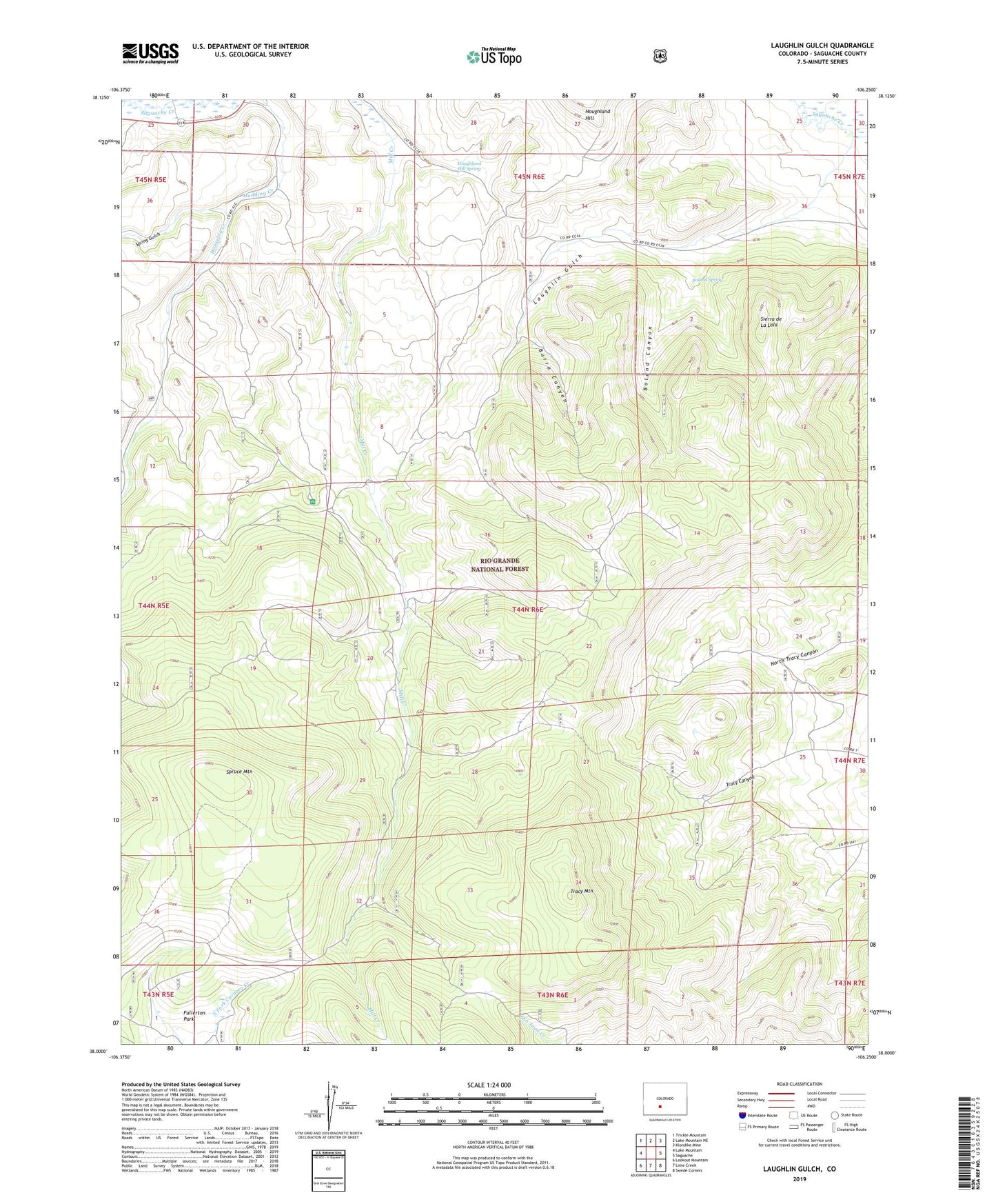
Laughlin Gulch Colorado US Topo Map
Couldn't load pickup availability
Also explore the Laughlin Gulch Forest Service Topo of this same quad for updated USFS data
2022 topographic map quadrangle Laughlin Gulch in the state of Colorado. Scale: 1:24000. Based on the newly updated USGS 7.5' US Topo map series, this map is in the following counties: Saguache. The map contains contour data, water features, and other items you are used to seeing on USGS maps, but also has updated roads and other features. This is the next generation of topographic maps. Printed on high-quality waterproof paper with UV fade-resistant inks.
Quads adjacent to this one:
West: Lake Mountain
Northwest: Trickle Mountain
North: Lake Mountain NE
Northeast: Klondike Mine
East: Saguache
Southeast: Swede Corners
South: Lime Creek
Southwest: Lookout Mountain
This map covers the same area as the classic USGS quad with code o38106a3.
Contains the following named places: Big Springs Campground, Boland Canyon, Boland Spring, Burro Canyon, Houghland Hill Spring, Houselog Creek, Laughlin Gulch, Norwood Junction Heliport, Saguache County, Sierra de La Lola, Spring Gulch, Spruce Mountain, Tracy Mountain, ZIP Code: 81149