MyTopo
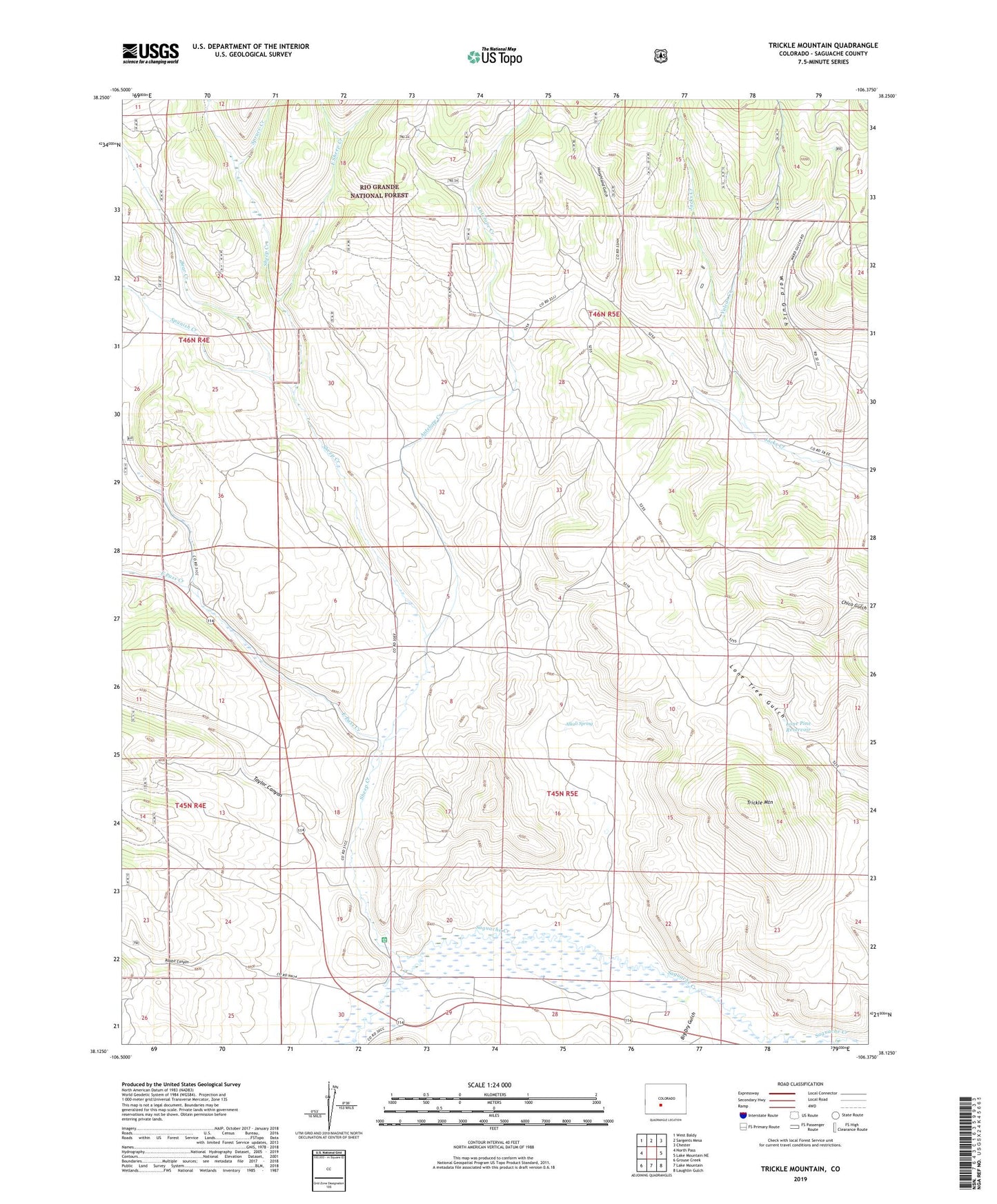
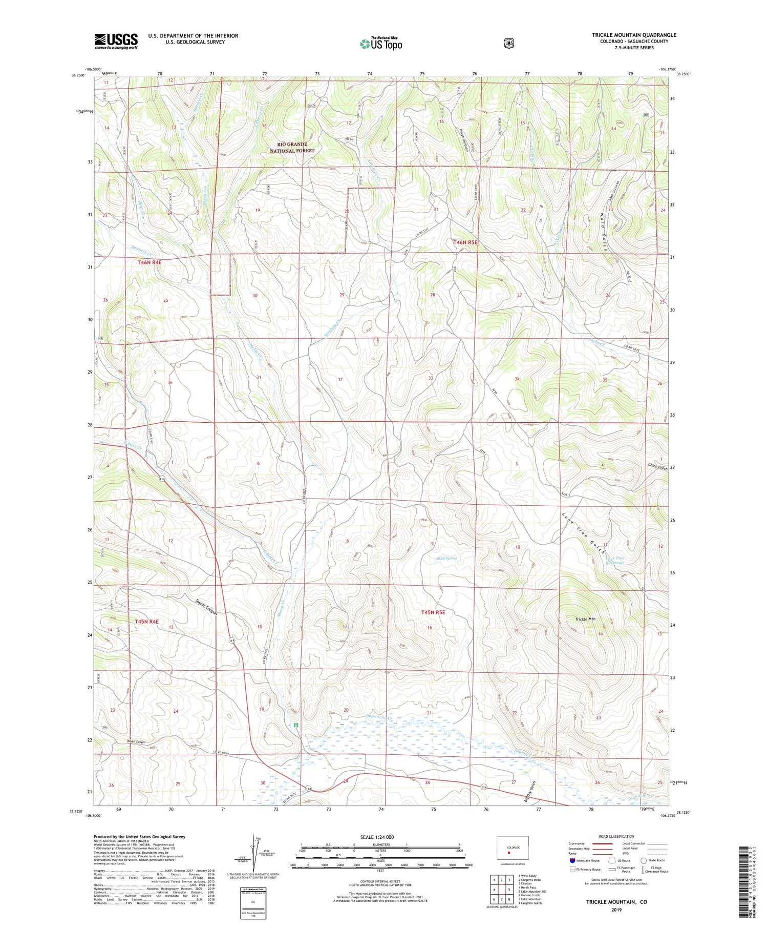
Trickle Mountain Colorado US Topo Map
Couldn't load pickup availability
Also explore the Trickle Mountain Forest Service Topo of this same quad for updated USFS data
2022 topographic map quadrangle Trickle Mountain in the state of Colorado. Scale: 1:24000. Based on the newly updated USGS 7.5' US Topo map series, this map is in the following counties: Saguache. The map contains contour data, water features, and other items you are used to seeing on USGS maps, but also has updated roads and other features. This is the next generation of topographic maps. Printed on high-quality waterproof paper with UV fade-resistant inks.
Quads adjacent to this one:
West: North Pass
Northwest: West Baldy
North: Sargents Mesa
Northeast: Chester
East: Lake Mountain NE
Southeast: Laughlin Gulch
South: Lake Mountain
Southwest: Grouse Creek
This map covers the same area as the classic USGS quad with code o38106b4.
Contains the following named places: Alkali Spring, Antelope Creek, Bear Creek, Big Dry Gulch, Commodore Ditch, East Pass Creek, East Sheep Creek, Houghland Gulch, Lone Pine Reservoir, Rabbit Canyon, Sheep Creek, Spanish Creek, Spruce Creek, Taylor Canyon, Trickle Mountain, Upper Saguache Guard Station, Vulcan Creek