MyTopo
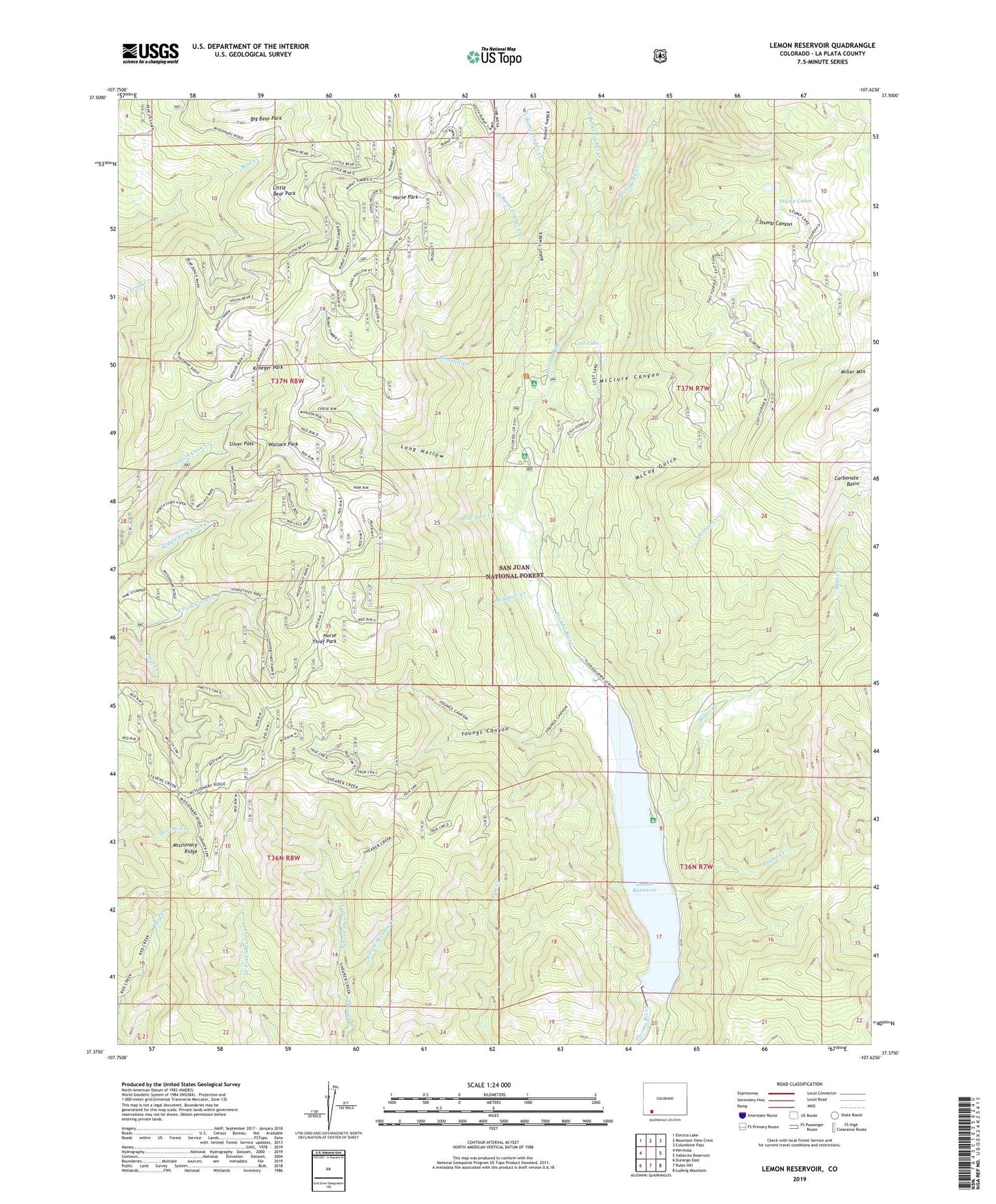
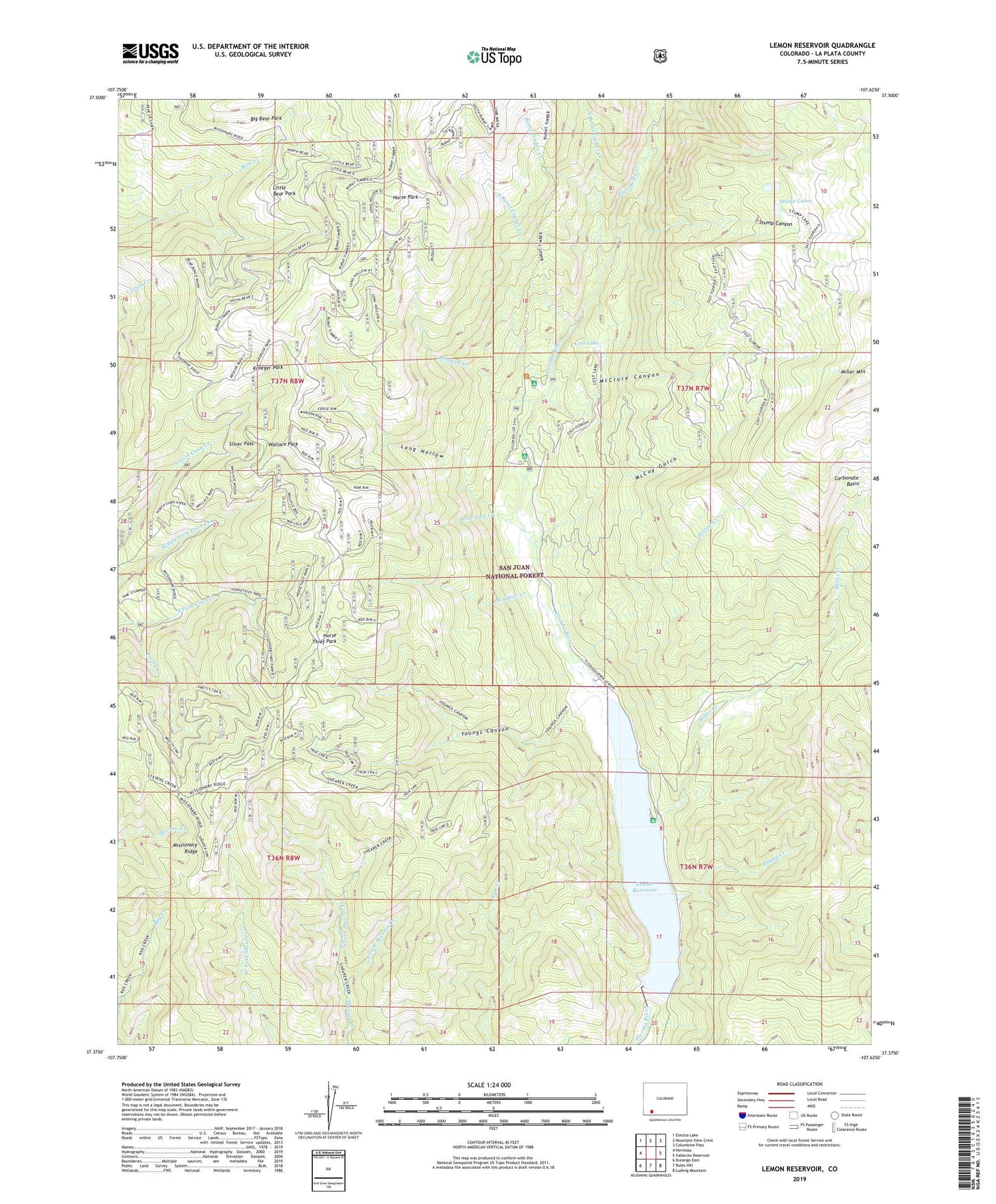
Lemon Reservoir Colorado US Topo Map
Couldn't load pickup availability
Also explore the Lemon Reservoir Forest Service Topo of this same quad for updated USFS data
2022 topographic map quadrangle Lemon Reservoir in the state of Colorado. Scale: 1:24000. Based on the newly updated USGS 7.5' US Topo map series, this map is in the following counties: La Plata. The map contains contour data, water features, and other items you are used to seeing on USGS maps, but also has updated roads and other features. This is the next generation of topographic maps. Printed on high-quality waterproof paper with UV fade-resistant inks.
Quads adjacent to this one:
West: Hermosa
Northwest: Electra Lake
North: Mountain View Crest
Northeast: Columbine Pass
East: Vallecito Reservoir
Southeast: Ludwig Mountain
South: Rules Hill
Southwest: Durango East
This map covers the same area as the classic USGS quad with code o37107d6.
Contains the following named places: Bear Creek Campground, Blodgett Creek, Burnt Timber Creek, Carbonate Basin, East Fork Shearer Creek, Florida Campground, Horse Park, Horse Thief Park, Kroeger Park, Lemon Dam, Lemon Dam Campground, Lemon Reservoir, Little Bear Park, Lone Tree Creek, Long Hollow, Lost Lake, McClure Canyon, McCoy Gulch, Miller Creek, Miller Mountain, Missionary Ridge, North Burnt Timber Creek, North Fork Shearer Creek, Pound Creek, Pretty Creek, San Juan National Forest, Silver Pass, South Burnt Timber Creek, Stump Canyon, Stump Lakes, Transfer Park Campground, Upper Lemon Picnic Area, Waldner Creek, Wallace Park, Willow Creek, Youngs Canyon