MyTopo
Lyons Colorado US Topo Map
Couldn't load pickup availability
Also explore the Lyons Forest Service Topo of this same quad for updated USFS data
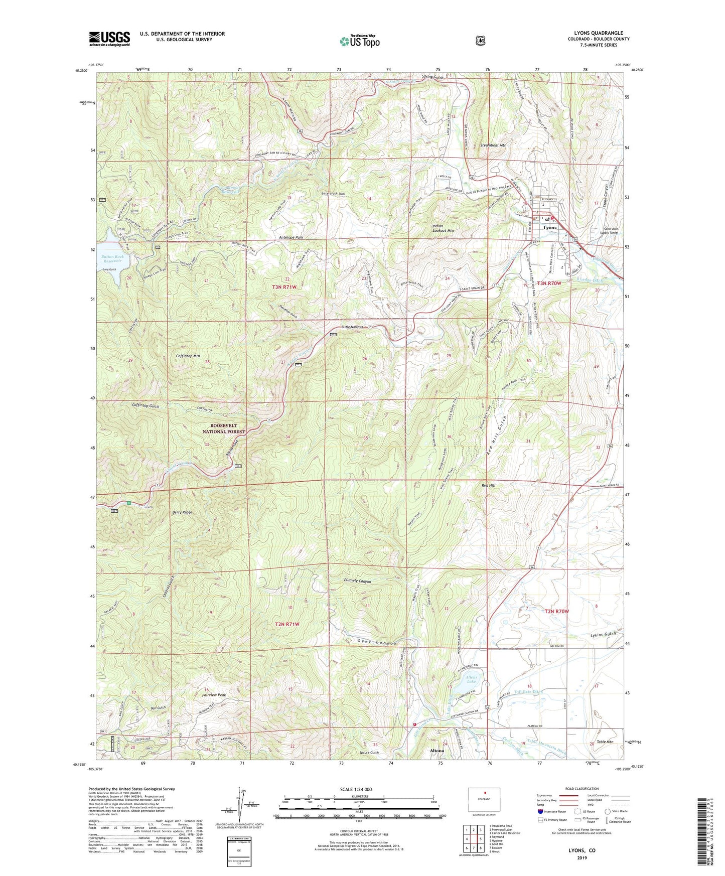
2022 topographic map quadrangle Lyons in the state of Colorado. Scale: 1:24000. Based on the newly updated USGS 7.5' US Topo map series, this map is in the following counties: Boulder. The map contains contour data, water features, and other items you are used to seeing on USGS maps, but also has updated roads and other features. This is the next generation of topographic maps. Printed on high-quality waterproof paper with UV fade-resistant inks.
Quads adjacent to this one:
West: Raymond
Northwest: Panorama Peak
North: Pinewood Lake
Northeast: Carter Lake Reservoir
East: Hygiene
Southeast: Niwot
South: Boulder
Southwest: Gold Hill
This map covers the same area as the classic USGS quad with code o40105b3.
Contains the following named places: Allen Lake Dam, Allens Lake, Altona, Altona Census Designated Place, Altona Grange, Antelope Park, Ball Gulch, Berry Ridge, Big Narrows, Brodies Saint Vrain Quarry, Button Rock Dam, Cal-Wood Mica Mine, Carol Gore Quarry, Cashier Mine, Central Gulch, Clemens Quarry, Coffintop Gulch, Coffintop Mountain, Copper Blush Mine, Crestview Estates, Dale Taylor Lease Quarry, Deadman Gulch, December Mine, Dewey Rocky Mountain Quarry, Durias Mine, Ellen Mine, Eureka Mine, Fairview Peak, Geer Canyon, Golden Age Mine, Hall Ranch, Hammons Quarry, Hardt Estates, Heil Quarry, Hercules Mine, Indian Lookout Mountain, Johnson Quarry, King Mountain Quarry, Kline Quarry, Lake Ditch, Lefthand Fire Protection District Central Station, Lefthand Fire Protection District Station 1, Lefthand Fire Protection District Station 3, Little Narrows, Long Gulch, Longfellow Mine, Longmont Powerplant, Longmont Reservoir, Lyons, Lyons Fire Protection District Station 1, Lyons Middle Senior High School, Lyons Park Estates, Lyons Post Office, Lyons Quarry, Mathews Ditch, McCall Quarries, North Saint Vrain Creek, Pickett Quarry, Plumely Canyon, Rawley Quarry, Red Hill, Red Hill Gulch, Rocking WP Pit, Rusty Gold and Cerite Claims, Saint Vrain Supply Tunnel, Sisk Mine, South Ledge Ditch, South Saint Vrain Creek, South Saint Vrain Picnic Ground, Sprague Red Pit, Spring Gulch, Steamboat Mountain, Steamboat Valley Quarry, Stone Canyon, Summers Quarry, Table Mountain, Toll Gate Ditch, Town of Lyons, United Building Stone Quarry, University of Colorado Quarry, ZIP Code: 80540


