MyTopo
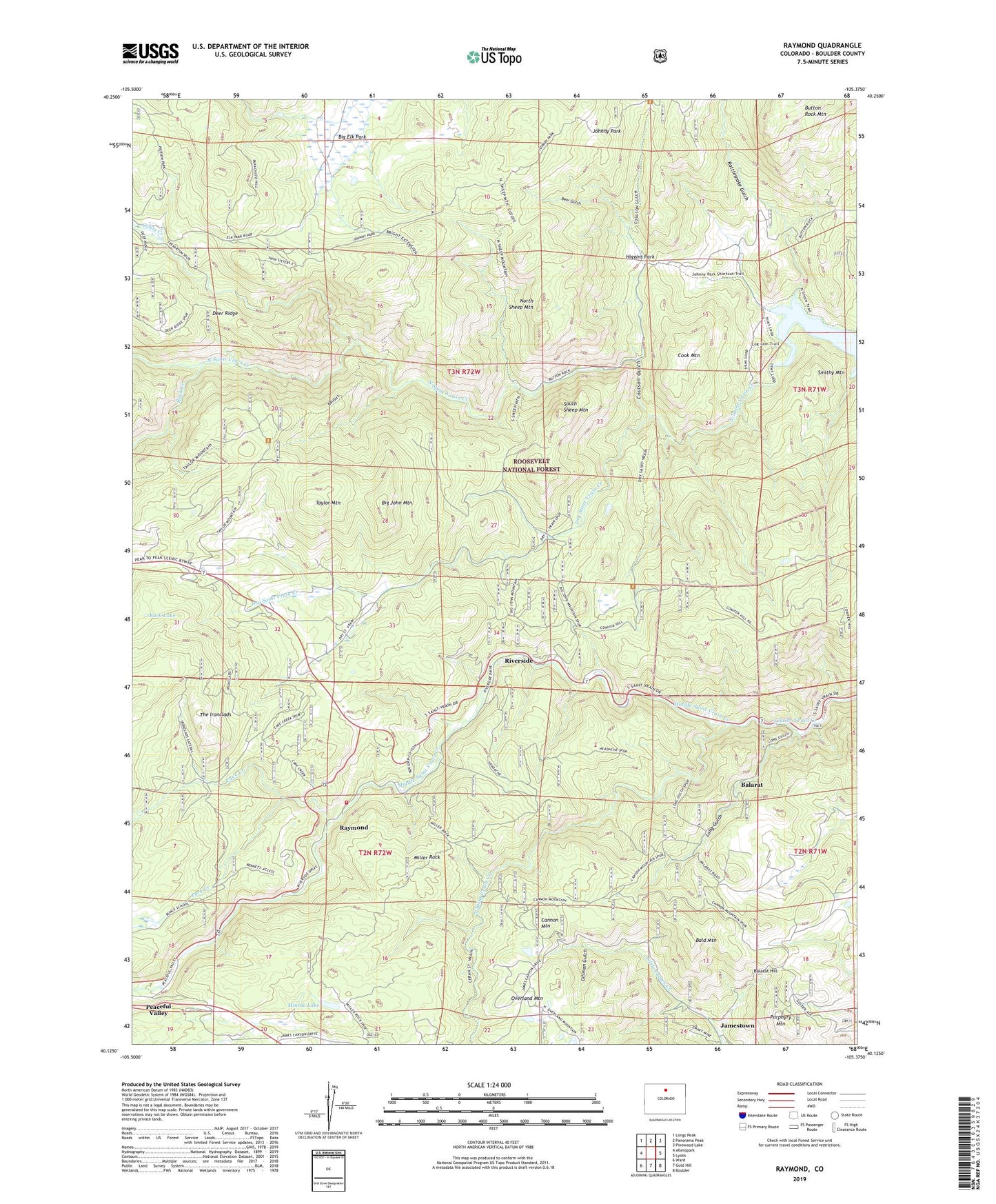
Raymond Colorado US Topo Map
Couldn't load pickup availability
Also explore the Raymond Forest Service Topo of this same quad for updated USFS data
2022 topographic map quadrangle Raymond in the state of Colorado. Scale: 1:24000. Based on the newly updated USGS 7.5' US Topo map series, this map is in the following counties: Boulder. The map contains contour data, water features, and other items you are used to seeing on USGS maps, but also has updated roads and other features. This is the next generation of topographic maps. Printed on high-quality waterproof paper with UV fade-resistant inks.
Quads adjacent to this one:
West: Allenspark
Northwest: Longs Peak
North: Panorama Peak
Northeast: Pinewood Lake
East: Lyons
Southeast: Boulder
South: Gold Hill
Southwest: Ward
This map covers the same area as the classic USGS quad with code o40105b4.
Contains the following named places: Alice Open Pit, Allenspark Fire Department Station 2 Raymond - Riverside, Argo Mine, Atlantic Mine, Balarat, Balarat Hill, Bald Mountain, Bear Gulch, Big Elk Ranch, Big John Mountain, Bradshaw Mine, Bright Trail, Buck Lake, Buckhorn Mine, Bunce School, Burlington Mine, Button Rock Reservoir, Cabin Creek, Cannon Mountain, Cave Creek, Ceran Vrain Trail, Consolation Mine, Cook Mountain, Coulson Gulch, Dry Saint Vrain Creek, Emmit Mine, Fourth of July Mine, Gillman Gulch, Glacier View Camp, Gold Cross Mine, Goldfinch Mine, Gresham, Higgins Park, Hopewell and Rusty Mine, Johnny Park, Long Gulch, Maud S Mine, McKinley-Stanley Mine, Middle Saint Vrain Creek, Miller Rock, Minnie Lake, Miranda A Johnson Lode, Mount Pleasant Mine, Nations Treasure Mine, North Sheep Mountain, North Sheep Mountain Trail, Orofino Mine, Overland Mine, Park Creek, Peaceful Valley, Peaceful Valley Post Office, Pine Valley, Porphyry Mountain, Rattlesnake Gulch, Raymond, Red Spruce Mine, Riverside, Rock Creek, Rock Ledge Park, Sky Ranch Estates, Smithy Mountain, Smuggler Mine, South Sheep Mountain, Taylor Mountain, The Ironclads