MyTopo
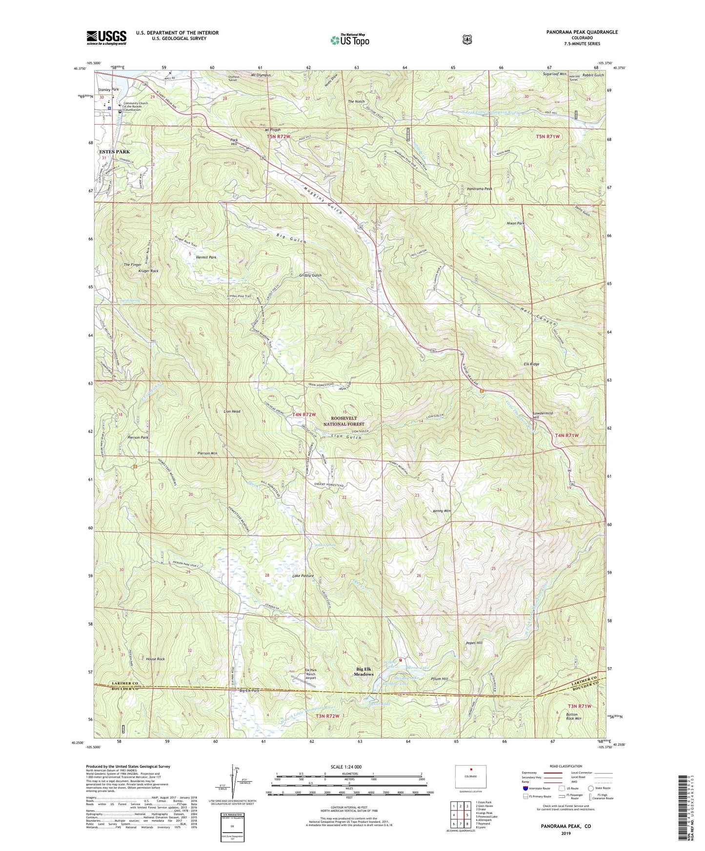
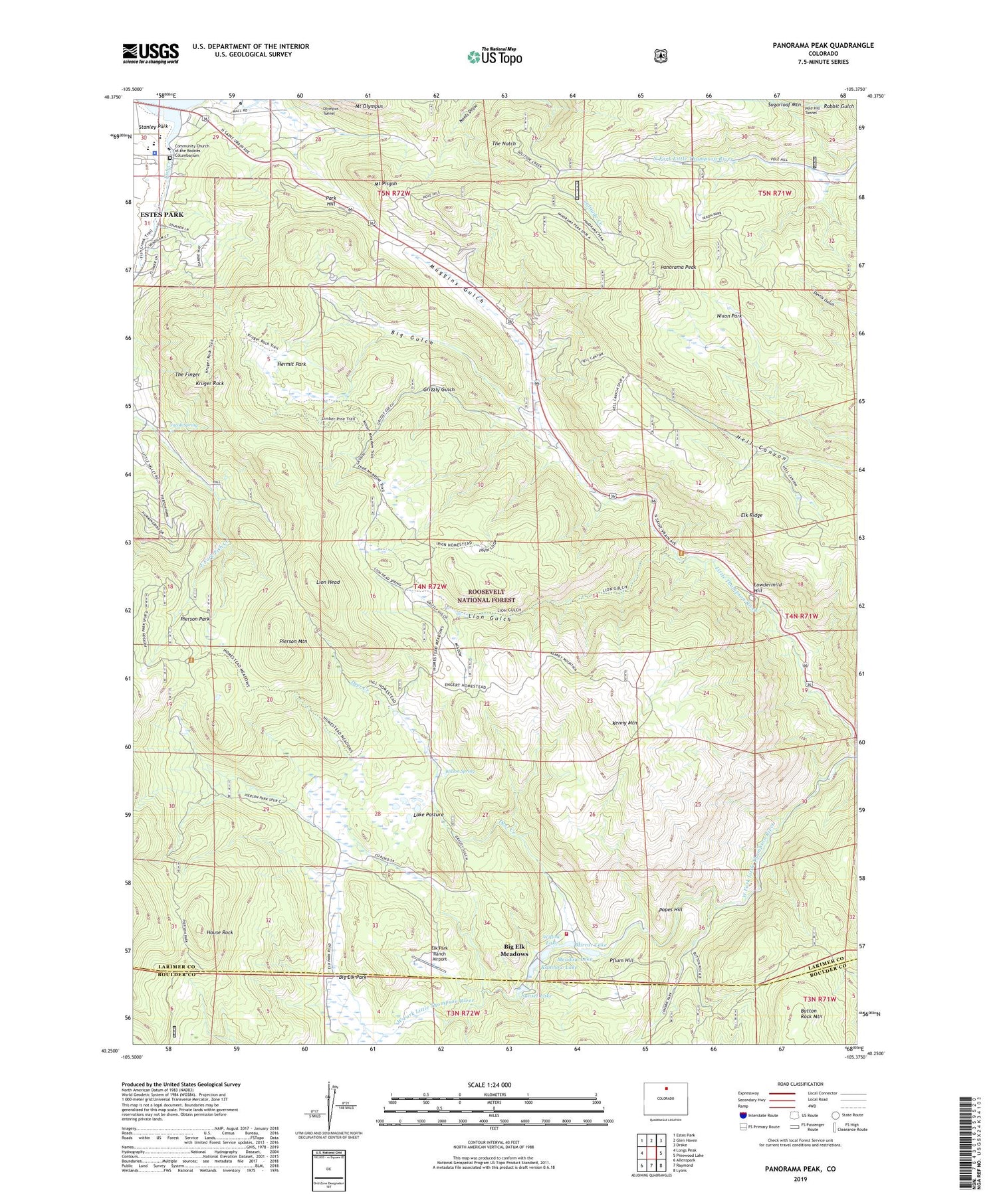
Panorama Peak Colorado US Topo Map
Couldn't load pickup availability
Also explore the Panorama Peak Forest Service Topo of this same quad for updated USFS data
2022 topographic map quadrangle Panorama Peak in the state of Colorado. Scale: 1:24000. Based on the newly updated USGS 7.5' US Topo map series, this map is in the following counties: Larimer, Boulder. The map contains contour data, water features, and other items you are used to seeing on USGS maps, but also has updated roads and other features. This is the next generation of topographic maps. Printed on high-quality waterproof paper with UV fade-resistant inks.
Quads adjacent to this one:
West: Longs Peak
Northwest: Estes Park
North: Glen Haven
Northeast: Drake
East: Pinewood Lake
Southeast: Lyons
South: Raymond
Southwest: Allenspark
This map covers the same area as the classic USGS quad with code o40105c4.
Contains the following named places: Big Elk Meadows, Big Elk Meadows Volunteer Fire Department, Big Elk Park, Big Gulch, Button Rock Mountain, Community Church of the Rockies Columbarium, Deer Creek, Elk Park Ranch Airport, Elk Ridge, Fish Creek, Greeno Mines, Grizzly Gulch, Hermit Park, House Rock, Jacob Spring, Kenny Mountain, Kruger Rock, Lake Pasture, Larimer County Sheriff's Office - Estes Park, Lion Gulch, Lion Gulch Trailhead, Lion Head, Lowdermild Hill, Meadow Lake, Meadowdale Ranch, Mirror Lake, Mount Olympus, Mount Olympus Mine, Mount Pisgah, Nixon Park, Panorama Peak, Park Hill, Park Hill Obervation Site, Pflum Hill, Pierson Mountain, Pierson Park, Pole Hill Tunnel, Popes Hill, Rainbow Lake, Stanley Park, Sunset Lake, The Finger, The Notch, West Fork Little Thompson River, Willow Lake, Wilson Spring