MyTopo
Topaz Mountain Colorado US Topo Map
Couldn't load pickup availability
Also explore the Topaz Mountain Forest Service Topo of this same quad for updated USFS data
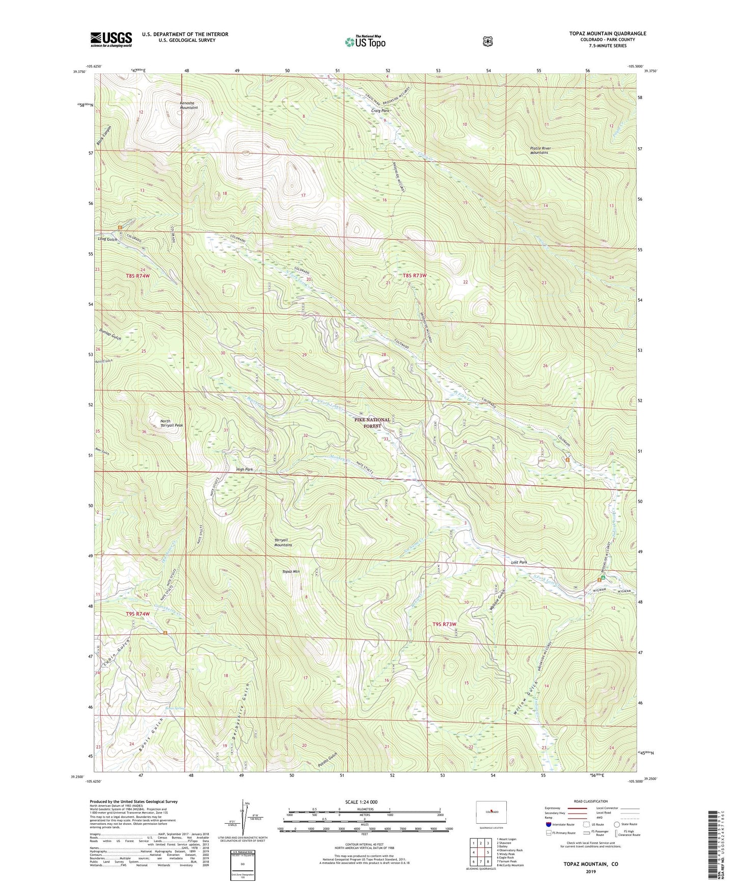
2022 topographic map quadrangle Topaz Mountain in the state of Colorado. Scale: 1:24000. Based on the newly updated USGS 7.5' US Topo map series, this map is in the following counties: Park. The map contains contour data, water features, and other items you are used to seeing on USGS maps, but also has updated roads and other features. This is the next generation of topographic maps. Printed on high-quality waterproof paper with UV fade-resistant inks.
Quads adjacent to this one:
West: Observatory Rock
Northwest: Mount Logan
North: Shawnee
Northeast: Bailey
East: Windy Peak
Southeast: McCurdy Mountain
South: Farnum Peak
Southwest: Eagle Rock
This map covers the same area as the classic USGS quad with code o39105c5.
Contains the following named places: Beaver Creek, Bonis Creek, Bonis Spring, Boss Mine, Brookside-McCurdy Trail, Gooseberry Creek, High Park, Hooper Trail, Hourglass Burn, Indian Creek, Kenosha Mountains, Lost Park, Lost Park Campground, Lost Park Cow Camp, Monkey Creek, Nate Stult Trail, No Name Creek, North Fork Lost Creek, North Tarryall Peak, Northup Lumber Camp, South Fork Lost Creek, Topaz Mountain, Wallace Gulch, Willow Gulch, Wire Patch Mine