MyTopo
Montrose East Colorado US Topo Map
Couldn't load pickup availability
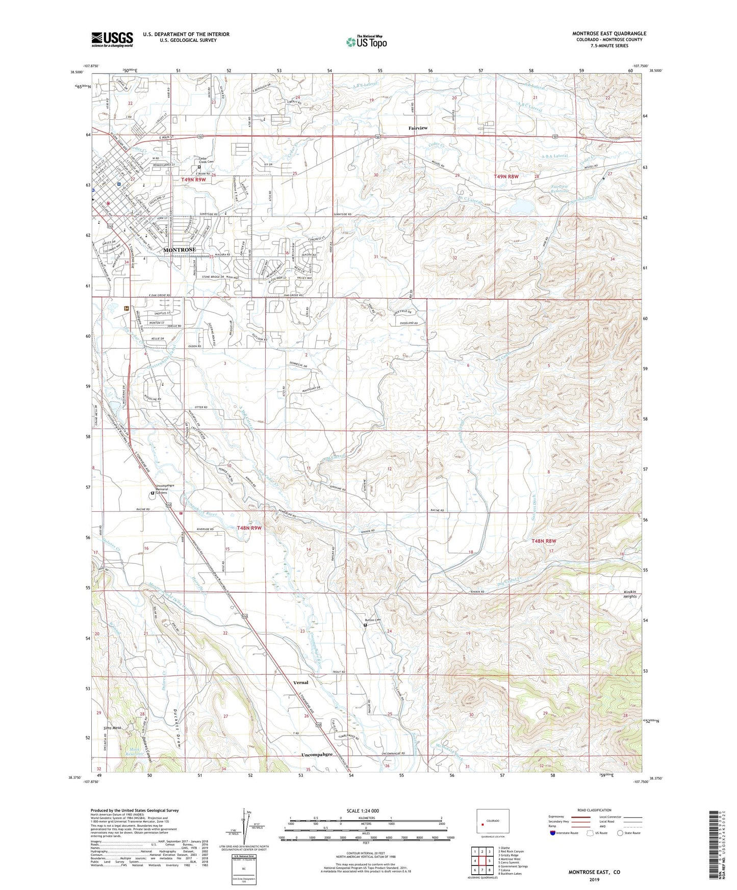
2022 topographic map quadrangle Montrose East in the state of Colorado. Scale: 1:24000. Based on the newly updated USGS 7.5' US Topo map series, this map is in the following counties: Montrose. The map contains contour data, water features, and other items you are used to seeing on USGS maps, but also has updated roads and other features. This is the next generation of topographic maps. Printed on high-quality waterproof paper with UV fade-resistant inks.
Quads adjacent to this one:
West: Montrose West
Northwest: Olathe
North: Red Rock Canyon
Northeast: Grizzly Ridge
East: Cerro Summit
Southeast: Buckhorn Lakes
South: Colona
Southwest: Government Springs
This map covers the same area as the classic USGS quad with code o38107d7.
Contains the following named places: A B A Lateral, A B C Lateral, A B E Lateral, A B Lateral, A C Lateral, A H Lateral, A M B Lateral, A M Lateral, Altrusa Park, Aquatic Center, Button Cemetery, Cedar Creek Cemetery, Centennial Middle School, Chief Ouray Memorial Park, Chipeta State Park, Christian Science Society, Church of Christ, City of Montrose, Columbine Middle School, Corey Gravel Pit, Dolores Canyon, Dry Cedar Creek, Duckett Draw, Fairview, Fairview Dam, Fairview Reservoir, Faith Baptist Church, Family Services Center Head Start, First Assembly of God, First Presbyterian Church, Garrett Ditch, Grace Baptist Church, Horsefly Creek, Johnson Elementary School, Johnson School, McDonald Ditch, Mock Number 2 Dam, Mock Reservoir, Montrose BLM Heliport, Montrose Botanic Gardens, Montrose Chamber of Commerce - Visitors Center, Montrose County Fairgrounds, Montrose Division, Montrose Fire Protection District Station 1, Montrose Fire Protection District Station 2, Montrose Golf Course, Montrose High School, Montrose Memorial Hospital, Montrose Memorial Hospital Heliport, Montrose Pavilion, Montrose Police Department, Montrose Senior Center, Morgan School, Pamona School, Pomona Elementary School, Riverside School, Rotary Park, Saint John E V Lutheran Church, Saint Marys Catholic Church, Saint Marys Parish Center, Saint Marys School, South Canal, The Church of Jesus Christ of Latter Day Saints, Tri - State CareFlight Medical Transport, Uncompahgre, Uncompahgre Farmers Market, Uncompahgre Memorial Gardens, United Church of Christ - Hillcrest Congregational Worship, United Methodist Church, Ute Indian Museum, Vernal, West Area Power Administration Operations Center Heliport, West Canal, Woods Stolport, ZIP Code: 81401