
MyTopo
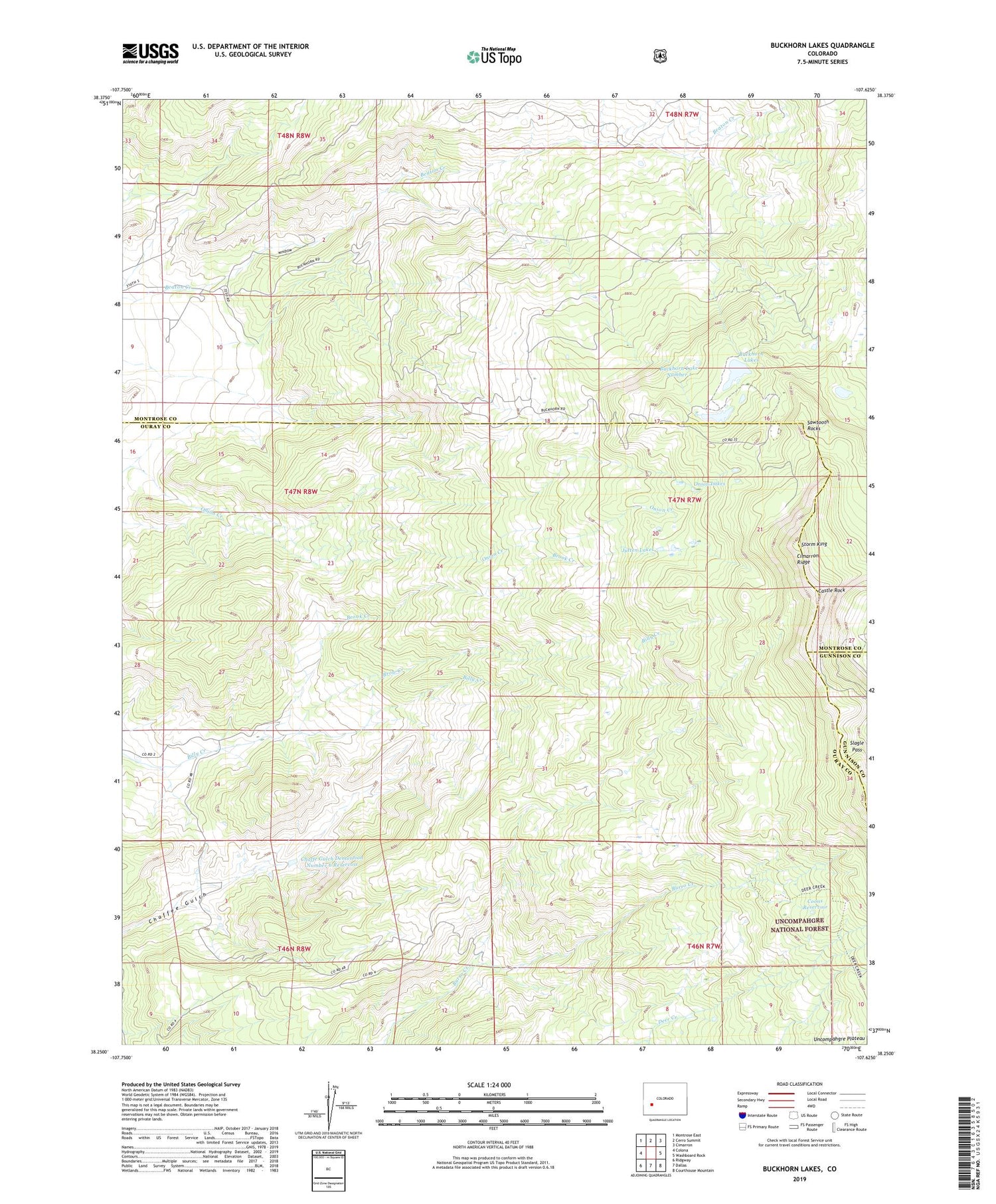
Buckhorn Lakes Colorado US Topo Map
Couldn't load pickup availability
Also explore the Buckhorn Lakes Forest Service Topo of this same quad for updated USFS data
2022 topographic map quadrangle Buckhorn Lakes in the state of Colorado. Scale: 1:24000. Based on the newly updated USGS 7.5' US Topo map series, this map is in the following counties: Ouray, Montrose, Gunnison. The map contains contour data, water features, and other items you are used to seeing on USGS maps, but also has updated roads and other features. This is the next generation of topographic maps. Printed on high-quality waterproof paper with UV fade-resistant inks.
Quads adjacent to this one:
West: Colona
Northwest: Montrose East
North: Cerro Summit
Northeast: Cimarron
East: Washboard Rock
Southeast: Courthouse Mountain
South: Dallas
Southwest: Ridgway
This map covers the same area as the classic USGS quad with code o38107c6.
Contains the following named places: Billy Creek State Wildlife Area, Brook Creek, Brow Creek, Buckhorn Lake Number 1, Buckhorn Lake Number 1 Dam, Buckhorn Lake Number 2, Buckhorn Lake Number 2 Dam, Buckhorn Lakes, Buckhorn Lakes Park, Castle Rock, Chaffe Gulch Dentention Number 6 Dam, Chaffe Gulch Dentention Number 6 Reservoir, Comerer Ranch, Coons Reservoir, Jutten Cabin, Jutten Lakes, KKXK-FM (Montrose), Onion Lakes, Sawtooth Rocks, Slagle Pass, Storm King, Tyler Mine


